Skip to content

Angul district

ଅନୁଗୋଳ ଜିଲ୍ଲା

Angul district in central Odisha: Talcher coalfield, NALCO smelter, Satkosia gorge on the Mahanadi and Deulajhari hot springs. History, places, travel.

Headquarters
Angul
Population (2011)
1,273,821
Area
6,375 sq km
Villages
1,896
Literacy (2011)
77.5%
Towns (2011)
18

Angul (ଅନୁଗୋଳ), also written Anugul, is a district in central Odisha whose headquarters is Angul town. Angul district is a major industrial centre, with the Talcher coalfield, large power stations and the NALCO aluminium smelter. It is also home to the forests of the Satkosia gorge on the Mahanadi and the hot springs of Deulajhari.

Angul lies close to the geographical centre of Odisha. It covers 6,375 sq km according to the district administration and the 2011 Census, though Wikipedia gives a smaller 6,232 sq km. Its population in 2011 was 1,273,821. About 16 percent of the people lived in towns, a relatively high share for Odisha because of the industrial townships around Angul and Talcher.

The district was created on 1 April 1993, when the old Dhenkanal district was divided under a state government notification of 27 March 1993. It brought together the former British-ruled Angul area and three former princely states, Talcher, Athmallik and Pallahara. These remain the district's four sub-divisions: Angul, Talcher, Athmallik and Pallahara.

Angul is often described as an industrial hub of Odisha. Wikipedia notes that Angul town, with 44,390 residents in 2011, is nicknamed the "Aluminium City", and that Talcher is called the "Black Diamond City" because of its coal. Large parts of the district are still forested and hilly, especially around Satkosia, Pallahara and Athmallik.

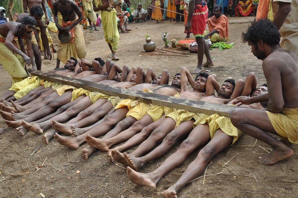
People of Angul district

Census 2011 counted 12,73,821 people in 2,97,050 households in Angul district. 16.2% lived in towns, and the literacy rate (age 7 and over) was 77.5%. The census recognised 18 towns in the district.

Population
12,73,821
6,55,718 male · 6,18,103 female
Households
2,97,050
about 4.3 people each
Literacy (age 7+)
77.5%
men 86.0% · women 68.6%
Females per 1,000 males
943
Girls per 1,000 boys (0–6)
889
People per km²
200
  • Rural10,67,275 (83.8%)
  • Urban2,06,546 (16.2%)
Scheduled Castes
2,39,552 (18.8%)
Scheduled Tribes
1,79,603 (14.1%)

What the 5,26,520 workers did

  • Cultivators80,508 (15.3%)
  • Agricultural labourers57,414 (10.9%)
  • Household industry19,840 (3.8%)
  • Other work1,59,785 (30.3%)
  • Marginal workers2,08,973 (39.7%)

Marginal workers worked less than six months of the year.

Source: Census of India 2011, Primary Census Abstract (district, sub-district and town level). Figures are from 2011, the most recent census with published district, town and village figures.

Facilities in the villages of Angul

How many of the 1,653 inhabited villages of this district had each facility within the village itself, from the Census 2011 Village Directory. Together the 1,870 villages cover 4,059 km², 37% of it sown with crops and 24% forest.

Education

  • Primary school1,369 of 1,653
  • Middle school768 of 1,653
  • Secondary school360 of 1,653
  • Senior secondary school48 of 1,653
  • Degree college34 of 1,653

Health

  • Primary health centre5 of 1,653
  • Health sub-centre158 of 1,653
  • Anganwadi centre1,169 of 1,653

Water & power

  • Treated tap water0 of 1,653
  • Hand pump1,532 of 1,653
  • Electricity for homes1,529 of 1,653

Roads & transport

  • All-weather road1,218 of 1,653
  • Public bus268 of 1,653
  • Mobile phone coverage1,510 of 1,653

Services

  • Post office or sub post office193 of 1,653
  • Commercial bank3 of 1,653
  • Ration (PDS) shop742 of 1,653
  • Weekly haat122 of 1,653
Primary schools
1,807
Middle schools
857
Secondary schools
423
Degree colleges
35
Primary health centres
6
Health sub-centres
158

Main crops named by villages: Black Gram (1,668), Paddy (1,495), Oil (108), Biri (79), Til (37), Vegetable (36), Regi (22), Groundnut (20). Handicrafts: Mason (11), Furnitures (6), Bamboo Products (3), Carpainter (3), Earthern Pots (2), Bidi Worker (1), Shop Seller (1), Tailoring (1).

Source: Census of India 2011, District Census Handbook: Village and Town Directory (Odisha). The facilities were recorded for the 2011 census (reference year 2009 for most items); many places have changed since. Facilities in towns are not included.

Towns of Angul

3 statutory towns (municipal corporation, municipality, notified area council or industrial township) and 15 census towns — places the census counted as urban but which are governed by gram panchayats.

TownTypePopulationLiteracyWards
AnugulMunicipality43,79591.3%23
TalcherMunicipality40,84185.2%21
NalcoCensus town19,64488.5%–
Dera Colliery TownshipCensus town15,78789.7%–
GhantapadaCensus town15,16983.8%–
AthmallikNotified Area Council12,29878.6%11
GotamaraCensus town7,42083.9%–
Kandasar (Part)Census town6,66888.9%–
Rengali Damproject TownshipCensus town6,34587.2%–
BudhapankaCensus town6,12979.4%–
NuahataCensus town5,92082.4%–
PalalahadaCensus town5,74986.1%–
Jorada (Bada)Census town4,42885.6%–
Kulad (Part)Census town4,25686.4%–
DanaraCensus town4,14480.4%–
T.T.P.S. TownshipCensus town3,61397.2%–
TipoCensus town2,98185.6%–
F.C.I. TownshipCensus town1,35997.6%–

Population of the town itself; for towns with outgrowths, the town page also gives the figure including them. Ward counts are the census wards of 2011.

Census sub-districts: town and country

Sub-districtPopulationRuralUrbanLiteracy
Bhusan Steel Limited1,0981,098088.3%
Palalahada66,38560,6365,74966.7%
Khamar63,42163,421070.6%
Rengali Damsite37,83831,4936,34579.4%
Kaniha55,67855,678078.2%
N.T.P.C.16,59016,590082.3%
Samal Barrage31,42128,4402,98176.7%
Talcher Sadar97,96857,12740,84181.6%
Colliery61,93823,22538,71382.8%
Bikrampur25,77219,9855,78784.5%
NALCO50,37519,80730,56884.6%
Banarpal78,77159,30219,46981.1%
Anugul1,55,2031,11,40843,79582.1%
Jarapada61,33561,335071.5%
Industrial34,31434,314073.7%
Chhendipada1,03,8041,03,804075.1%
Handapa51,62051,620076.7%
Kishorenagar56,42356,423079.2%
Athmallik56,95344,65512,29877.7%
Kiakata15,77715,777076.2%
Thakurgarh49,89849,898074.0%
Purunakot29,52629,526066.2%
Bantala71,71371,713076.1%

Odisha's census sub-districts are police-station areas, not revenue tahasils.

History

Angul was once a small hill kingdom. According to a history published by the Angul district court, the British took over the area in 1803, after the Marathas lost Odisha. Raja Somnath Singh Jagadeb, who ruled from 1813, is described as the last king of Angul. He resisted the East India Company and was deposed; his territory was confiscated on 16 September 1848, while Wikipedia dates his revolt and removal to 1847. Angul was then run directly as a government estate.

In 1891 Angul was made a separate district, with the Khondmals (present-day Kandhamal) attached to it. Wikipedia says the district was abolished when Odisha became a province in 1936. Its area then became part of Cuttack district and, after 1949, of Dhenkanal district.

The neighbouring princely states each had their own histories, according to the district administration:

  • Talcher was renamed by King Padmanabha Birabara Harichandan after the family goddess Taleswari.
  • Athmallik takes its name from eight (atha) chieftains called malliks, among whom the territory was once divided. Forty-two kings of the dynasty are said to have ruled, with capitals moving from Hondapa to Thakurgarh, Nuagaon and Purunagarh.
  • Pallahara was founded before the 18th century by Santosh Pala, who took the name Ganeswar Pala on becoming king.

In the 1930s the Praja Mandal movement spread through these states. In Talcher it was led by Pabitra Mohan Pradhan and reached its peak in 1938–39. The former Chief Minister Nabakrushna Choudhury also organised Praja Mandal work from Angul and later lived there. Talcher merged with India on 1 January 1948, and the area remained part of Dhenkanal district until Angul district was created in 1993.

Places to visit

Satkosia and Tikarpada

The Satkosia gorge, where the Mahanadi flows between forested hills, is the district's best-known natural sight. Nature camps at Tikarpada, Chhotkei, Purunakote and elsewhere offer boating, walks and birdwatching. The river is a habitat of the gharial and mugger crocodile, and the forests hold leopards, elephants and sloth bears. A plan to bring tigers from Madhya Pradesh was suspended in 2019 after a translocated tiger died. See our Satkosia travel guide.

Deulajhari

Deulajhari, about 6 km from Athmallik and 90 km from Angul, is described by the district administration as an ancient centre of Shaivism. The temple of Siddheswar stands among hot springs. The administration says 24 of the 84 springs recorded in temple tradition are still active, with water from about 40°C to 62°C. Named springs include Agnikunda, Taptakunda and Himakunda. A temple of Maa Maheshwari also stands within the complex. The 24-acre site is enclosed by a dense natural grove. The nearest station is Boinda, about 44 km away.

Saila Srikhetra, Angul

The Jagannath temple of Angul, known as Saila Srikhetra, stands on top of the Sunasagad hill in the town.

Rengali

The Rengali dam across the Brahmani has a hydroelectric power station and a large reservoir, listed by the district administration for its scenery.

Other sites

  • Kosala Ramachandi: a village shrine about 28 km from Angul on the Angul–Bagedia road.
  • Bhimkand: a sacred site with a reclining image known as the "sleeping Vishnu", listed by Odisha Tourism.
  • Maa Hingula temple: a goddess shrine that Odisha Tourism recommends visiting.

How to reach

  • By air: Biju Patnaik International Airport, Bhubaneswar, about 140 km away according to Odisha Tourism; Wikipedia gives about 150 km from the state capital.
  • By rail: Angul and Talcher have railway stations with express and passenger services. Boinda is the closest station for Athmallik and Deulajhari.
  • By road: National and state highways link Angul with Dhenkanal, Cuttack and Bhubaneswar to the east and Sambalpur to the west, with regular bus and taxi services.

Odisha Tourism suggests at least two days and October to March for the district. Satkosia is also good for wildlife from mid-February to mid-June. See how to reach Odisha and the map of Odisha.

Temples (11)

  • Binikei Temple · ବିନିକେଇ
  • Bringesvara Mahadeva temple
  • Budhi Thakurani Temple · ବୁଢ଼ୀଠାକୁରାଣୀ ମନ୍ଦିର
  • Hingula Temple · ହିଙ୍ଗୁଳା ମନ୍ଦିର
  • Jagannath Temple, Angul
  • Jagannath Temple, Banarpal · ଜଗନ୍ନାଥ ମନ୍ଦିର, ବଅଁରପାଳ
  • Kosala Ramchandi Temple · କୋଶଳା ରାମଚଣ୍ଡୀ ମନ୍ଦିର
  • Maa Lobhi Thakurani Temple · ଲୋଭୀ ଠାକୁରାଣୀ
  • Maheshwari Temple · ମାହେଶ୍ଵରୀ ମନ୍ଦିର
  • Pranabesvara Temple
  • Siddeshwar Temple, Athmallik · ସିଦ୍ଧେଶ୍ଵର ମନ୍ଦିର, ଆଠମଲ୍ଲିକ

Photos and map links in the temple directory. Today's tithi, sunrise and Rahu Kala here.

Protected monuments (2)

Monuments of National Importance protected by the Archaeological Survey of India. All of Odisha.

Railway stations

12 stations and 1 halts inside the district, as mapped on OpenStreetMap; some on new lines may not yet have regular trains.

Culture and festivals

Angul shares the festival calendar of central Odisha, including Raja, Nuakhai and Durga Puja. Local goddesses have their own yearly festivals. The district administration notes the annual Lovi Thakurani yatra at Garh Santry, and Odisha Tourism lists visits to the Maa Hingula temple. Jagannath worship centres on Saila Srikhetra in Angul town.

Odia is spoken by about 95.5 percent of people (2011), with Ho and Hindi as the next most common languages.

Food

Odisha Tourism's Angul guide highlights:

Geography and climate

Angul is bordered by Dhenkanal and Cuttack to the east; Deogarh, Kendujhar and Sundargarh to the north; Sambalpur and Subarnapur to the west; and Boudh and Nayagarh to the south.

Two great rivers cross the district. The Brahmani flows through the north and east, where the Rengali dam has been built across it. The Mahanadi forms the south, where it cuts a gorge about 22 km long through the Eastern Ghats at Satkosia. The Satkosia Tiger Reserve (about 964 sq km, declared in 2007) combines the Satkosia Gorge and Baisipalli wildlife sanctuaries. The Satkosia Gorge wetland is also a Ramsar site.

FeatureDetail
Area6,375 sq km (district administration); 6,232 sq km (Wikipedia)
Main riversMahanadi, Brahmani
Protected areaSatkosia Tiger Reserve
Average annual rainfallAbout 1,421 mm (district); about 1,273 mm at Angul town
SummerTemperatures near 47°C at their peak
WinterLows around 10°C

Economy

Angul is one of the most industrialised districts in Odisha.

  • Coal: The Talcher coalfield covers about 500 sq km. The Geological Survey of India estimates its reserves at about 38.65 billion tonnes, the highest of any coalfield in India. Coal was first found at Gopalprasad in 1837, and the field has been operated by Mahanadi Coalfields Limited since 1992. The coal is of relatively low grade with a high ash content, but it is mined on a large scale: Wikipedia reports that nearly 100,000 tonnes a day were being sent to power stations across eastern and southern India by 2011.
  • Power: NTPC runs large thermal power stations in the Talcher area, fed by local coal.
  • Aluminium: NALCO's smelter at Angul has a capacity of 4.60 lakh tonnes a year, according to the company.
  • Fertiliser: Talcher Fertilizers Limited is building a coal-gasification ammonia–urea plant at Talcher with a planned capacity of about 1.27 million tonnes a year.

Agriculture and forest produce remain important outside the industrial belt.

Climate of Angul

In Angul district (at 20.84°N, 85.10°E), the hottest month is May (average highs of 38°C) and the coolest nights come in Jan (16°C). About 1530 mm of rain falls in a year, most of it in the monsoon; Jul is the wettest month.

JanFebMarAprMayJunJulAugSepOctNovDec
Average high (°C)273136383835313131312927
Average low (°C)161822252727262525231916
Rainfall (mm)19172830652273663662611142219
Rainy days2133516242420922

Averages for 1995–2024 at that point (119 m above sea level), from the Open-Meteo historical weather API (ERA5 reanalysis by ECMWF/Copernicus, CC BY 4.0) — modelled values on a ~25 km grid, not station readings from the India Meteorological Department. A rainy day has 2.5 mm or more.

Notable people

  • Pabitra Mohan Pradhan (born 8 February 1908 at Poipala, Talcher sub-division), leader of the Talcher Praja Mandal movement. He was elected from Talcher in 1952 and 1957, defeated two former rulers in Talcher and Pallahara in 1961, and later served as a state cabinet minister.
  • Nabakrushna Choudhury (1901–1984), Chief Minister of Odisha from 1950 to 1956. He was born at Kherasa (now in Jagatsinghpur district) but carried the Praja Mandal movement forward from Angul and spent his later years there.

Blocks, sub-districts, panchayats & villages

Choose a block, sub-district or town to see its details and its gram panchayats and villages. Open any village for its own page.

Counts below: Local Government Directory, December 2022 snapshot (LGD villages, which can differ from the district administration's revenue-village count).

Blocks
8
Sub-districts
22
GPs
226
LGD villages
1,896

Community development block

Anugul

Gram panchayats
34
Villages
237
LGD block code
3276
District
Angul
Open full block page

Villages (…)

All blocks in Angul

BlockGPsVillagesVillage pop.LiteracyST share
Anugul342371,66,79074.7%10.8%
Athmallik243391,10,55275.7%23.9%
Banarpal361621,60,54679.3%4.0%
Chhendipada341901,66,75173.5%10.7%
Kaniha272351,32,71778.0%8.3%
Kishorenagar232511,06,59678.1%20.2%
Palalahada272961,24,05767.8%40.8%
Talacher2118699,17579.2%10.1%

GPs and villages: Local Government Directory (Dec 2022). Village population, literacy and Scheduled Tribe share: sum of the block's villages in Census of India 2011, Primary Census Abstract (village level).

All census sub-districts

Towns (urban local bodies)

Assembly constituencies in Angul

Source: Local Government Directory (lgdirectory.gov.in), Government of India — data dump of December 2022 via github.com/planemad/india-local-government-directory. Sub-districts follow the Local Government Directory, which for Odisha uses the Census sub-districts (police-station areas) — these are not the same as revenue tahasils. Boundaries and names change over time; check the district administration for current status.

Frequently asked questions

When was Angul district formed?

Angul became a separate district on 1 April 1993, when the undivided Dhenkanal district was split into Dhenkanal and Angul under a state notification dated 27 March 1993.

Why is Angul called an industrial hub?

Angul district has the Talcher coalfield, operated by Mahanadi Coalfields Limited, large NTPC power stations, and NALCO's aluminium smelter at Angul, with a capacity of 4.60 lakh tonnes a year according to NALCO.

What is Deulajhari famous for?

Deulajhari, near Athmallik, has a Shiva temple of Siddheswar surrounded by hot springs. The district administration says 24 of an original 84 springs are active, with water between about 40°C and 62°C.

Is Satkosia in Angul district?

Yes. The Satkosia Tiger Reserve, where the Mahanadi flows through a 22 km gorge, lies in Angul and Nayagarh districts.

How far is Angul from Bhubaneswar?

Odisha Tourism gives the distance from Biju Patnaik International Airport, Bhubaneswar, as about 140 km, and Wikipedia puts the district about 150 km from the state capital.

Sources & references

  1. 1Anugul District: Census 2011 data — Census2011.co.in (compiled from Census of India 2011)
  2. 2Angul District (home page and profile) — District Administration, Angul, Government of Odisha
  3. 3A Short History of Angul — District Court, Angul (eCourts)
  4. 4Deulajhari, Athamallik — District Administration, Angul (NIC)
  5. 5Angul (Anugola) — Odisha Tourism, Government of Odisha
  6. 6Aluminium Smelter — National Aluminium Company Limited (NALCO)
  7. 7Two mighty kings trounced by Praja Mandal leader — Sambad English
  8. 8Angul district — Wikipedia

Last reviewed . How we check articles

Report an error