Skip to content

Balangir district

ବଲାଙ୍ଗୀର ଜିଲ୍ଲା

Balangir (Bolangir) district in western Odisha, once the Chauhan-ruled Patna State, known for Ranipur Jharial, Harishankar temple and Kosli culture.

Headquarters
Balangir
Population (2011)
1,648,997
Area
6,575 sq km
Villages
1,790
Literacy (2011)
64.7%
Towns (2011)
8

Balangir (ବଲାଙ୍ଗୀର), also spelt Bolangir, is a district in western Odisha. It was once the heart of the Chauhan-ruled Patna State. Balangir district is known for the Yogini temple at Ranipur Jharial, the Harishankar temple on the Gandhamardan hills, Sambalpuri handloom and the Kosli (Sambalpuri) language and culture.

The district takes its name from its headquarters town. According to the district administration, the name comes from Balaramgarh, a fort built in the 16th century by Balaram Deo, the Chauhan prince who also founded the Sambalpur kingdom.

Balangir covers 6,575 sq km and had 1,648,997 people at the 2011 Census. It is largely rural: only about 12 percent of people lived in towns. It has three sub-divisions (Balangir, Patnagarh and Titlagarh) and 14 blocks. Scheduled Tribes make up about a fifth of the population and Scheduled Castes a little under a fifth.

The present district took shape after the princely states of Patna and Sonepur merged with Odisha on 1 January 1948. Sonepur was later separated as Subarnapur district on 1 April 1993.

Balangir is part of Odisha's drought-prone western uplands. Seasonal migration for work has long been a feature of rural life, and in 2006 the central government listed it among India's 250 most backward districts.

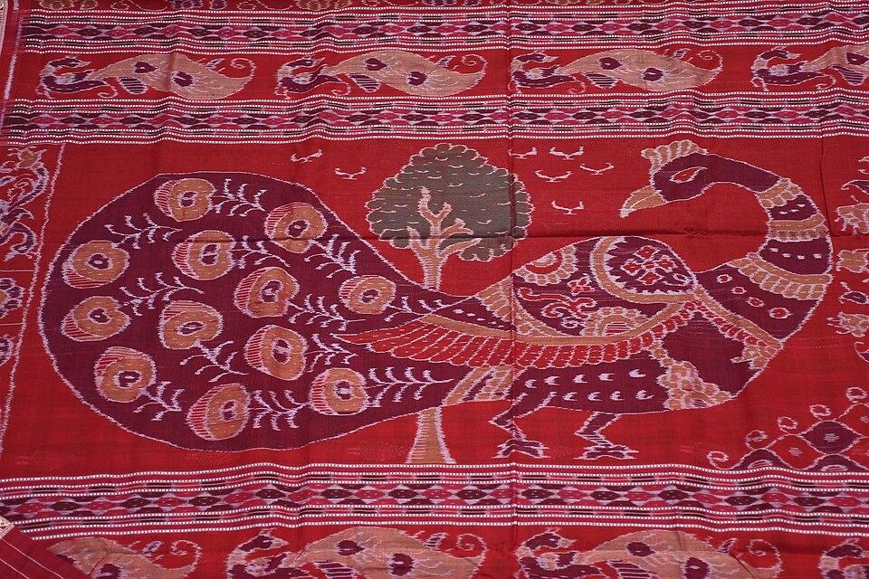
People of Balangir district

Census 2011 counted 16,48,997 people in 4,14,749 households in Balangir district. 12.0% lived in towns, and the literacy rate (age 7 and over) was 64.7%. The census recognised 8 towns in the district.

Population
16,48,997
8,30,097 male · 8,18,900 female
Households
4,14,749
about 4.0 people each
Literacy (age 7+)
64.7%
men 75.8% · women 53.5%
Females per 1,000 males
987
Girls per 1,000 boys (0–6)
955
People per km²
251
  • Rural14,51,616 (88.0%)
  • Urban1,97,381 (12.0%)
Scheduled Castes
2,94,777 (17.9%)
Scheduled Tribes
3,47,164 (21.1%)

What the 7,20,601 workers did

  • Cultivators1,33,145 (18.5%)
  • Agricultural labourers1,07,920 (15.0%)
  • Household industry16,721 (2.3%)
  • Other work1,44,441 (20.0%)
  • Marginal workers3,18,374 (44.2%)

Marginal workers worked less than six months of the year.

Source: Census of India 2011, Primary Census Abstract (district, sub-district and town level). Figures are from 2011, the most recent census with published district, town and village figures.

Facilities in the villages of Balangir

How many of the 1,751 inhabited villages of this district had each facility within the village itself, from the Census 2011 Village Directory. Together the 1,783 villages cover 5,359 km², 53% of it sown with crops and 13% forest.

Education

  • Primary school1,717 of 1,751
  • Middle school761 of 1,751
  • Secondary school314 of 1,751
  • Senior secondary school62 of 1,751
  • Degree college35 of 1,751

Health

  • Primary health centre6 of 1,751
  • Health sub-centre215 of 1,751
  • Anganwadi centre1,642 of 1,751

Water & power

  • Treated tap water0 of 1,751
  • Hand pump1,749 of 1,751
  • Electricity for homes1,323 of 1,751

Roads & transport

  • All-weather road1,165 of 1,751
  • Public bus161 of 1,751
  • Mobile phone coverage1,726 of 1,751

Services

  • Post office or sub post office304 of 1,751
  • Commercial bank2 of 1,751
  • Ration (PDS) shop627 of 1,751
  • Weekly haat192 of 1,751
Primary schools
2,079
Middle schools
848
Secondary schools
419
Degree colleges
40
Primary health centres
12
Health sub-centres
215

Main crops named by villages: Paddy (1,370), Cotton (441), Vegetables (299), Pulses (270), Sugarcane (119), Maize (91), Wheat (82), Vegetable (82). Handicrafts: Saree (7), Weaving Products (3), Cloth (3), Painting (3), Carpentery (2), Earthern Pots (1), Bamboo Work (1).

Source: Census of India 2011, District Census Handbook: Village and Town Directory (Odisha). The facilities were recorded for the 2011 census (reference year 2009 for most items); many places have changed since. Facilities in towns are not included.

Towns of Balangir

4 statutory towns (municipal corporation, municipality, notified area council or industrial township) and 4 census towns — places the census counted as urban but which are governed by gram panchayats.

TownTypePopulationLiteracyWards
BalangirMunicipality98,23886.3%21
TitlagarhNotified Area Council31,25882.1%17
KantabanjiNotified Area Council21,81978.5%16
PatnagarhNotified Area Council21,02479.7%15
LoisingaCensus town6,22080.8%–
BangomundaCensus town5,75968.9%–
BadmalCensus town5,43195.7%–
TushuraCensus town4,82385.5%–

Population of the town itself; for towns with outgrowths, the town page also gives the figure including them. Ward counts are the census wards of 2011.

Census sub-districts: town and country

Sub-districtPopulationRuralUrbanLiteracy
Loisinga1,52,8651,46,6456,22070.1%
Balangir3,27,0812,28,84398,23874.3%
Tushura1,85,0281,80,2054,82367.1%
Patnagarh1,68,3251,47,30121,02466.5%
Khaprakhol89,81989,819056.3%
Turekela52,42252,422048.3%
Belpara1,16,1361,16,136056.5%
Saintala1,48,9911,43,5605,43164.0%
Kantabanji72,11550,29621,81961.9%
Bangomunda74,57968,8205,75956.3%
Sindhekela98,77798,777053.7%
Titlagarh1,62,8591,28,79234,06763.4%

Odisha's census sub-districts are police-station areas, not revenue tahasils.

History

The area was part of ancient South Kosala. In the medieval period, according to tradition, descendants of Prithviraj Chauhan settled in the region after his defeat by Muhammad of Ghor. Ramai Deo is regarded as the founder of Chauhan rule at Patnagarh, usually dated to about 1360 CE. Patnagarh was the capital of a confederacy of hill forts known as the Athara Garh (eighteen forts).

In the 16th century Balaram Deo founded the Sambalpur kingdom, and the Balaramgarh fort gave Balangir its name. Over time the capital of Patna State moved from Patnagarh to Balangir, and Patnagarh declined after the 16th century.

The last ruler of Patna State, Maharaja Rajendra Narayan Singh Deo (1912–1975), took full powers in 1933. After the state merged with Odisha in 1948, he led the Ganatantra Parishad and served as Chief Minister of Odisha from 1967 to 1971, the first Chief Minister of the state from outside the Congress.

Places to visit

Ranipur Jharial

Ranipur Jharial, near Titlagarh and Kantabanji, is one of Odisha's most important early temple sites. Its best-known monument is a circular, roofless (hypaethral) Chausath Yogini temple, about 50 feet across, dated to the 9th or 10th century CE. A shrine with a dancing Shiva stands at the centre. Sources differ on how many of the 64 Yogini images survive; counts range from about 48 to 62. The site also has a large brick temple and several smaller stone temples. Ranipur Jharial was the first Yogini temple to be described by a modern scholar, Major-General John Campbell, in 1853.

Harishankar

Harishankar lies on the southern slope of the Gandhamardan hills, about 81 km from Balangir according to Odisha Tourism. The temple is dedicated to both Hari (Vishnu) and Shankar (Shiva) and was built in the 14th century at the wish of Queen Durlabha Devi, wife of the Chauhan king Vaijjal Dev. A stream tumbles over granite beside the temple, and pilgrims bathe in its pools. A trail across the hill links Harishankar with the Nrusinghanath temple on the northern slope, in Bargarh district. A dancing Ganesha image of about the 12th century has been found at the site, and some scholars link the plateau between the two temples with Parimalagiri, a Buddhist monastery mentioned by the Chinese pilgrim Xuanzang.

Patnagarh

Patnagarh, about 36 km from Balangir, was the first capital of the Chauhan kings. The Patneswari Temple, of the goddess worshipped by the Patna royal family, stands here.

Balangir town

The town has the Sailashree Palace of the former rulers and several temples, including shrines of Samaleswari and Patneswari.

Titlagarh

Titlagarh is a railway junction and market town, best known for its extreme summer heat; visit between November and February.

How to reach

  • Air: Veer Surendra Sai Airport, Jharsuguda, is the nearest airport. Biju Patnaik International Airport in Bhubaneswar is farther away.
  • Rail: Balangir is on the Jharsuguda–Sambalpur–Titlagarh line, and Titlagarh is a junction for the Raipur and Vizianagaram lines. The Khurda Road–Balangir railway project, built in stages, is designed to give the district a more direct rail link with Bhubaneswar.
  • Road: Balangir town is about 327 km from Bhubaneswar by road, according to Wikipedia. Harishankar is about 335 km from Bhubaneswar, according to Odisha Tourism.

See also neighbouring Subarnapur, Bargarh, Kalahandi and Nuapada, or browse all districts of Odisha.

Temples (4)

  • Chausathi Jogini Temple (Ranipur-Jharial) · ଚଉଷଠି ଯୋଗିନୀ ମନ୍ଦିର (ରାଣୀପୁର-ଝରିଆଲ)
  • Harishankar Temple · ହରିଶଙ୍କର ମନ୍ଦିର
  • Indralatha Temple
  • Somesvara Temple

Photos and map links in the temple directory. Today's tithi, sunrise and Rahu Kala here.

Protected monuments (1)

Monuments of National Importance protected by the Archaeological Survey of India. All of Odisha.

Railway stations

15 stations and 0 halts inside the district, as mapped on OpenStreetMap; some on new lines may not yet have regular trains.

Culture and festivals

Balangir is one of the heartlands of the Kosli or Sambalpuri language. In the 2011 Census about a fifth of the people returned Sambalpuri as their mother tongue, with most of the rest returning Odia.

Sambalpuri, also called Kosli or Western Odia, is written in the Odia script. The 2011 Census counted about 2.63 million native speakers, and Balangir holds about an eighth of them. Speakers often regard it as a language of its own, while linguists usually class it as a variety of Odia; a survey in 2006 found that it shares about three-quarters of its basic vocabulary with standard Odia. Supporters campaign for its inclusion in the Eighth Schedule of the Constitution.

  • Nuakhai, the harvest festival of new rice in Bhadraba (August–September), is the district's biggest family festival.
  • Sambalpuri dance forms such as Dalkhai and Rasarkeli are performed at festivals and weddings.
  • Handloom: Balangir is one of the main weaving districts for the GI-registered Sambalpuri saree and bandha fabrics. See Odisha's GI tags.
  • Temple festivals: Harishankar draws large crowds at Shivaratri, Makar Sankranti and during the Magha fair.

Food

Balangir's food belongs to the western Odisha tradition. Chaula bara, crisp fried rice-flour fritters served with green chillies and tamarind soup, is a popular snack in Balangir and nearby towns. Gupchup, the local name for pani puri, is a favourite street food. Mutton curry (mansa jhol) is a feature of feasts such as Chhadkhai. Sweets include rasbaraa and tikhri, and bamboo-shoot dishes made with kardi and hendua are common.

Geography and climate

Balangir lies in the basin of the Tel, a major tributary of the Mahanadi. Other rivers include the Suktel, Ang, Jira and Saleshing. The Gandhamardan hills, rising to about 1,005 m (3,296 ft), lie on the district's border with Bargarh and are known for their medicinal plants. Other high points include Butel and Chahdli.

The Gandhamardan range covers about 190 sq km across Balangir and Bargarh. The Botanical Survey of India has recorded about 220 plant species of medicinal value there, and two Ayurvedic colleges and hospitals stand on either side of the hills. The hills also hold bauxite. A lease granted to the state-owned company BALCO in 1983 led to a long local protest movement, and the mining project was abandoned in the late 1980s. In March 2023 the range was declared a Biodiversity Heritage Site, according to Down To Earth. Sources differ slightly on its highest point, giving about 1,005 m or 1,060 m.

The district is famous for its harsh summers. Titlagarh is regularly among the hottest places in India and has recorded 50.1 °C.

Climate featureTypical value
SummerVery hot; Wikipedia gives average summer highs of about 48.7 °C
WinterMild; average winter temperature about 16.6 °C
Annual rainfallAbout 1,443 mm, mostly June to September
Climate typeTropical wet and dry (Köppen Aw)

Economy

Agriculture is the mainstay of Balangir, with paddy grown largely on rain-fed land. Because rainfall is uneven and droughts are frequent, many rural workers migrate seasonally to other states. Handloom weaving provides important additional income in weaving villages. The district has an Indian Ordnance Factory, and Balangir town is a trading centre for the surrounding area. Bhima Bhoi Medical College and Hospital, inaugurated in 2018, has strengthened the town's role as a health and education centre.

Climate of Balangir

In Balangir district (at 20.71°N, 83.48°E), the hottest month is May (average highs of 41°C) and the coolest nights come in Jan (15°C). About 1440 mm of rain falls in a year, most of it in the monsoon; Jul is the wettest month.

JanFebMarAprMayJunJulAugSepOctNovDec
Average high (°C)283236404136313031313028
Average low (°C)151823272927252524221916
Rainfall (mm)1511111334215402376264701513
Rainy days1111214232318611

Averages for 1995–2024 at that point (188 m above sea level), from the Open-Meteo historical weather API (ERA5 reanalysis by ECMWF/Copernicus, CC BY 4.0) — modelled values on a ~25 km grid, not station readings from the India Meteorological Department. A rainy day has 2.5 mm or more.

Notable people

  • Rajendra Narayan Singh Deo (1912–1975): last Maharaja of Patna State and Chief Minister of Odisha from 1967 to 1971.
  • Ramai Deo: traditionally regarded as the founder of Chauhan rule at Patnagarh in the 14th century.
  • Balaram Deo: Chauhan prince credited with the Balaramgarh fort that gave Balangir its name, and with founding the Sambalpur kingdom.
  • Rasanara Parwin: cricketer from Balangir who has played for the India women's team.

Blocks, sub-districts, panchayats & villages

Choose a block, sub-district or town to see its details and its gram panchayats and villages. Open any village for its own page.

Counts below: Local Government Directory, December 2022 snapshot (LGD villages, which can differ from the district administration's revenue-village count).

Blocks
14
Sub-districts
12
GPs
319
LGD villages
1,790

Community development block

Agalpur

Gram panchayats
20
Villages
108
LGD block code
3284
District
Balangir
Open full block page

Villages (…)

All blocks in Balangir

BlockGPsVillagesVillage pop.LiteracyST share
Agalpur2010896,93869.5%12.8%
Balangir271301,06,03567.2%21.4%
Bangomunda261321,09,87354.0%16.4%
Belpara241201,28,91656.0%34.4%
Deogaon2612997,64567.3%20.4%
Gudvella138954,05964.5%29.9%
Khaprakhol2113494,96458.3%34.8%
Loisinga2010890,22969.1%18.3%
Muribahal221621,15,87455.4%24.2%
Patnagarh301621,28,71164.8%31.6%
Puintala251361,11,63570.7%6.8%
Saintala221431,14,77564.5%20.1%
Titlagarh241311,19,55159.1%20.2%
Turekela1910583,30750.0%34.7%

GPs and villages: Local Government Directory (Dec 2022). Village population, literacy and Scheduled Tribe share: sum of the block's villages in Census of India 2011, Primary Census Abstract (village level).

All census sub-districts

Towns (urban local bodies)

  • Balangir · Municipality
  • Kantabanji · Notified Area Council
  • Patnagarh · Notified Area Council
  • Titlagarh · Municipality
  • Tusura · Notified Area Council · no matching Census 2011 town

Assembly constituencies in Balangir

Source: Local Government Directory (lgdirectory.gov.in), Government of India — data dump of December 2022 via github.com/planemad/india-local-government-directory. Sub-districts follow the Local Government Directory, which for Odisha uses the Census sub-districts (police-station areas) — these are not the same as revenue tahasils. Boundaries and names change over time; check the district administration for current status.

Frequently asked questions

Is Balangir the same as Bolangir?

Yes. Balangir and Bolangir are two spellings of the same district and town in western Odisha.

What is Ranipur Jharial famous for?

Ranipur Jharial has a rare circular, roofless temple of the 64 Yoginis, dated to around the 9th–10th century CE, along with other early temples. It was the first Yogini temple to be described by modern scholars, in 1853.

How far is Harishankar from Balangir?

Odisha Tourism gives Harishankar as about 81 km from Balangir and about 335 km from Bhubaneswar by road.

Why is Titlagarh known for heat?

Titlagarh in Balangir district regularly records some of India's highest summer temperatures. Wikipedia gives its record high as 50.1 °C, in June.

Sources & references

  1. 1Districts of Orissa – Census 2011 population — Census2011.co.in (compiled from Census of India 2011)
  2. 2Balangir District at a Glance — District Administration, Balangir, Government of Odisha
  3. 3Balangir district — Wikipedia
  4. 4Chausath Yogini Temple, Ranipur Jharial — Wikipedia
  5. 5Rajendra Narayan Singh Deo — Wikipedia
  6. 6Titlagarh — Wikipedia
  7. 7Protests reignite over mining fears in Odisha's sacred Gandhamardan Hills — Down To Earth

Last reviewed . How we check articles

Report an error