Skip to content

Balasore district

ବାଲେଶ୍ୱର ଜିଲ୍ଲା

Balasore (Baleshwar) is a coastal north Odisha district known for Chandipur's vanishing sea, the DRDO test range, Panchalingeswar and Fakir Mohan.

Headquarters
Balasore
Population (2011)
2,320,529
Area
3,806 sq km
Villages
2,976
Literacy (2011)
79.8%
Towns (2011)
5

Balasore (ବାଲେଶ୍ୱର), officially spelled Baleshwar since June 2026, is a coastal district in the far north of Odisha. It lies between the Bay of Bengal and the hills along the Mayurbhanj border, and touches West Bengal to the north-east. The district headquarters is Balasore town.

Balasore is known for Chandipur, where the sea retreats for kilometres at low tide, and for the DRDO Integrated Test Range nearby. Other attractions are the hill shrine of Panchalingeswar, the Khirachora Gopinath temple at Remuna and the quiet beach at Talasari. It is also the home district of Fakir Mohan Senapati, the father of modern Odia fiction. Fakir Mohan University and Fakir Mohan Medical College in Balasore town are named after him.

Balasore became a district in October 1828 under the Bengal Presidency, and it joined the new province of Odisha in 1936. Bhadrak, formerly a sub-division, became a separate district in 1993. Today Balasore has two sub-divisions, Balasore and Nilagiri, and 12 blocks.

At the 2011 Census the district had 2,320,529 people, with a literacy rate of 79.79%. Sources differ on the area: the Census-based figure used here is 3,806 sq km, while the district administration gives 3,634 sq km.

People of Balasore district

Census 2011 counted 23,20,529 people in 5,33,001 households in Balasore district. 10.9% lived in towns, and the literacy rate (age 7 and over) was 79.8%. The census recognised 5 towns in the district.

Population
23,20,529
11,85,787 male · 11,34,742 female
Households
5,33,001
about 4.4 people each
Literacy (age 7+)
79.8%
men 87.0% · women 72.3%
Females per 1,000 males
957
Girls per 1,000 boys (0–6)
943
People per km²
639
  • Rural20,67,236 (89.1%)
  • Urban2,53,293 (10.9%)
Scheduled Castes
4,78,586 (20.6%)
Scheduled Tribes
2,75,678 (11.9%)

What the 9,32,707 workers did

  • Cultivators2,27,102 (24.3%)
  • Agricultural labourers1,65,636 (17.8%)
  • Household industry17,203 (1.8%)
  • Other work2,08,123 (22.3%)
  • Marginal workers3,14,643 (33.7%)

Marginal workers worked less than six months of the year.

Source: Census of India 2011, Primary Census Abstract (district, sub-district and town level). Figures are from 2011, the most recent census with published district, town and village figures.

Facilities in the villages of Balasore

How many of the 2,633 inhabited villages of this district had each facility within the village itself, from the Census 2011 Village Directory. Together the 2,926 villages cover 3,159 km², 54% of it sown with crops and 3% forest.

Education

  • Primary school1,987 of 2,633
  • Middle school1,303 of 2,633
  • Secondary school631 of 2,633
  • Senior secondary school81 of 2,633
  • Degree college59 of 2,633

Health

  • Primary health centre4 of 2,633
  • Health sub-centre190 of 2,633
  • Anganwadi centre2,081 of 2,633

Water & power

  • Treated tap water0 of 2,633
  • Hand pump2,221 of 2,633
  • Electricity for homes2,321 of 2,633

Roads & transport

  • All-weather road1,369 of 2,633
  • Public bus148 of 2,633
  • Mobile phone coverage2,548 of 2,633

Services

  • Post office or sub post office545 of 2,633
  • Commercial bank12 of 2,633
  • Ration (PDS) shop985 of 2,633
  • Weekly haat238 of 2,633
Primary schools
2,627
Middle schools
1,480
Secondary schools
790
Degree colleges
64
Primary health centres
10
Health sub-centres
190

Main crops named by villages: Paddy (2,008), Vegetables (87), Betel (77), Coconut (28), Til (22), Khadi (14), Inkada (13), Ground Nuts (10). Handicrafts: Leaf Plates (1).

Source: Census of India 2011, District Census Handbook: Village and Town Directory (Odisha). The facilities were recorded for the 2011 census (reference year 2009 for most items); many places have changed since. Facilities in towns are not included.

Towns of Balasore

5 statutory towns (municipal corporation, municipality, notified area council or industrial township) and 0 census towns — places the census counted as urban but which are governed by gram panchayats.

TownTypePopulationLiteracyWards
BaleshwarMunicipality1,18,16288.1%52
RemunaNotified Area Council33,37878.4%32
SoroNotified Area Council32,53184.6%19
JaleshwarNotified Area Council25,74781.5%17
NilagiriNotified Area Council17,26477.5%13

Population of the town itself; for towns with outgrowths, the town page also gives the figure including them. Ward counts are the census wards of 2011.

Census sub-districts: town and country

Sub-districtPopulationRuralUrbanLiteracy
Raibania80,47280,472065.7%
Jaleswar1,49,1701,23,42325,74780.3%
Bhograi1,88,5591,88,559084.7%
Kamarda96,16296,162084.7%
Baliapal1,69,9581,69,958082.4%
Singla1,34,1781,34,178080.2%
Basta1,51,9151,51,915079.3%
Rupsa25,18925,189073.6%
Baleshwar Sadar1,79,0921,79,092077.3%
Sahadevkhunta10,23310,233070.0%
Chandipur40,58840,588074.1%
Balaramgadi Marine5,2375,237063.2%
Bampada11,28711,287077.5%
Remuna91,66858,29033,37875.2%
Nilagiri1,32,1681,14,90417,26471.5%
Berhampur57,61457,614064.0%
Oupada39,75939,759071.1%
Khaira1,39,7771,39,777082.1%
Soro3,11,5072,78,97632,53183.7%
Similia1,61,6231,61,623081.6%
Baleshwar (M)1,44,37301,44,37387.5%

Odisha's census sub-districts are police-station areas, not revenue tahasils.

History

The district administration describes the region as part of ancient Kalinga and later of the Toshali and Utkal regions. Its harbours made it an early meeting point with European traders. Wikipedia records an English East India Company factory at Balasore from 1633, and Odisha Tourism points to Dutch tombs and an old British cemetery in the town as reminders of that period. Other European companies also traded here.

The Marathas held the area until the Treaty of Deogaon in 1803 brought it under the Company. In October 1828 Balasore became one of three districts of the Odisha division under Bengal. Inland, the hill state of Nilagiri, ruled according to tradition by a Nagabanshi line, remained a separate princely state. Its last Raja signed the instrument of accession on 1 January 1948 after agitation by local freedom fighters, and the state was absorbed into Balasore district in 1949. It joined the new province of Odisha on 1 April 1936.

Balasore figures prominently in the freedom struggle. On 9 September 1915 the Bengali revolutionary Jatindranath Mukherjee (Bagha Jatin) and four companions fought police and troops at Chashakhand near the Budhabalanga. Bagha Jatin died of his wounds in Balasore hospital the next day.

On 13 April 1930 volunteers broke the salt law at Inchudi, about 19 km from Balasore. Leaders included Acharya Harihar Das, and women such as Rama Devi took part. The event is remembered as the "Dandi of Odisha".

Places to visit

Chandipur beach

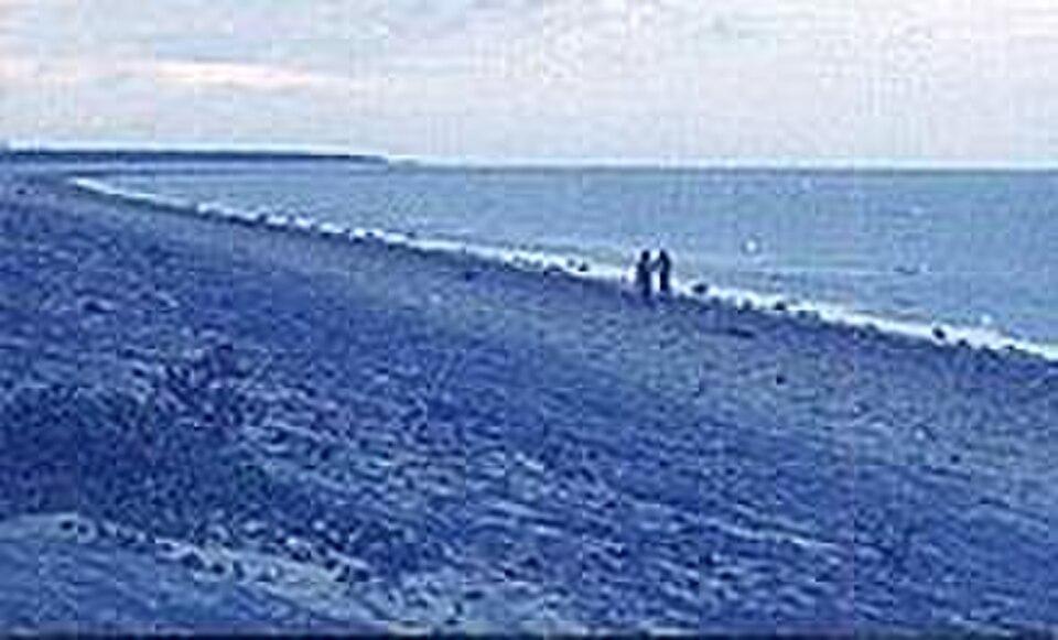
At Chandipur the sea recedes for several kilometres at low tide, so visitors can walk out on the seabed and watch the water return. It is not a swimming beach. See the Chandipur travel guide.

Panchalingeswar

On a hillock near the Nilagiri hills, about 28 km south-west of Balasore town, five Shiva lingas sit in the bed of a perennial stream that flows over them. Worshippers lie flat on the rocks to reach and touch the lingas. According to tradition, Sita installed the lingas during the exile of the Ramayana; another account links them to the demon king Banasura. Odisha Tourism places Panchalingeswar about 32 km from Chandipur.

Khirachora Gopinath, Remuna

This Vaishnava shrine at Remuna, which the district administration also calls "Remuna Gupta Vrindaban", is linked to the legend of Gopinath stealing khira (sweetened milk) for the saint Madhavendra Puri, which gave the deity the name Khirachora, the milk thief. Wikipedia dates the temple to about 1300 CE, and Janmashtami is its chief festival.

Talasari and Udaypur beaches

These long, quiet beaches near the West Bengal border are known for red crabs and casuarina groves. Odisha Tourism puts Talasari about 85 km from Chandipur.

Nilagiri

Nilagiri, the former capital of the Nilagiri princely state, is the gateway to the district's hill belt. Odisha Tourism lists its Jagannath temple among the sights near Chandipur, and Panchalingeswar and the Kuldiha forest lie within easy reach.

Chandaneswar

The Shiva temple at Chandaneswar is known for its Chadak Mela festival, according to the district administration.

Kuldiha Wildlife Sanctuary

This forest sanctuary, about 30 km from Chandipur, has elephants, leopards, gaur and giant squirrels, along with hornbills and many orchids.

Balaramgadi and Balasore town

Balaramgadi, where the Budhabalanga meets the sea about 3 km from Chandipur, is a busy fishing harbour. In Balasore town, the Dutch tombs and a newly built Jagannath temple, about 7 km from the headquarters, are local landmarks.

How to reach

  • By air: The nearest major airport is Biju Patnaik International Airport, Bhubaneswar.
  • By rail: Balasore station is on the main Howrah–Chennai line, with frequent trains from Kolkata and Bhubaneswar.
  • By road: National Highways 16 and 18 pass through Balasore. The town is about 215 km from Bhubaneswar and 240 km from Kolkata. Chandipur is about 16 km from the town.

See how to reach Odisha. Balasore is a convenient stop on the way to Similipal National Park in neighbouring Mayurbhanj.

Temples (10)

  • Baneswara Temple, Balasore
  • Brahmani Temple
  • Brahmani temple · ବ୍ରାହ୍ମଣୀ ମନ୍ଦିର
  • Jagannath Temple
  • Jagannath Temple, Nilagiri · ଜଗନ୍ନାଥ ମନ୍ଦିର, ନୀଳଗିରି
  • Khirachora Gopinatha Temple · କ୍ଷୀରଚୋରା ଗୋପୀନାଥ ମନ୍ଦିର
  • Langleswar Temple · ଲଙ୍ଗଳେଶ୍ଵର ମନ୍ଦିର
  • Mahishamardini Temple
  • Marichi Temple · ମାରିଚୀ ମନ୍ଦିର
  • Shyamsundarji Temple

Photos and map links in the temple directory. Today's tithi, sunrise and Rahu Kala here.

Railway stations

12 stations and 5 halts inside the district, as mapped on OpenStreetMap; some on new lines may not yet have regular trains.

Culture and festivals

Balasore shares the main festivals of coastal Odisha: Rath Yatra, Durga Puja, Raja Parba and Makar Sankranti. Large fairs on Makar Sankranti are held at the Makara Muni temple. The Chadak Mela of Chandaneswar is a distinctive local fair.

Because the district borders Bengal, its culture shows both Odia and Bengali influences. Wikipedia's analysis of the 2011 Census reports that about 88% of residents speak Odia, followed by Santali, Urdu and Bengali. The Santal and other Adivasi communities of the hill belt keep their own languages, music and festivals.

Food

Seafood dominates Balasore's table, especially fish, crabs and prawns landed at Balaramgadi and other harbours. A mustard-based fish curry such as machha besara is typical. Khira (milk-rice pudding) has a special place because of its link to the Khirachora Gopinath temple at Remuna.

Geography and climate

Broadly, the district has three belts: a coastal belt of sandy beaches, creeks and mudflats; a fertile central alluvial plain; and, in the north-west around Nilagiri, a belt of forested hills that run into the Similipal massif. Wikipedia gives the coastline as about 137 km.

The Subarnarekha enters the district from the north and reaches the sea there. The Budhabalanga flows from Mayurbhanj to the coast near Chandipur and Balaramgadi.

The Kuldiha Wildlife Sanctuary, declared on 4 January 1984, covers about 273 sq km of hill forest. It is linked to Similipal through the Sukhupada and Nato hills and forms part of the Mayurbhanj Elephant Reserve.

FeatureDetail
CoastAbout 137 km on the Bay of Bengal
RiversSubarnarekha, Budhabalanga
HillsNilagiri hills, bordering Mayurbhanj
Protected areaKuldiha Wildlife Sanctuary, about 273 sq km (1984)
RainfallAbout 1,568 mm a year, according to the district administration

The climate is hot and humid. The monsoon arrives in mid-June, and the district administration says about three-quarters of the rain falls between June and December. The coast is exposed to cyclones, so check India Meteorological Department warnings when travelling.

Economy

The district administration names industry, agriculture, fishing and tourism as Balasore's four main sources of income. Paddy is the chief crop of the central plain. Marine fishing supports the coast, and the administration lists tyre, paper and pharmaceutical units among the larger employers.

The Integrated Test Range of the Defence Research and Development Organisation (DRDO), set up in 1982, is a major centre for trials of rockets, missiles and airborne weapon systems. Its Launch Complex-III is at Chandipur, while a second launch complex is on Abdul Kalam Island off the coast of neighbouring Bhadrak district. Parts of the shore near Chandipur are restricted on test days, so visitors should follow local instructions. The district is also an education hub, with Fakir Mohan University and Fakir Mohan Medical College and Hospital.

Climate of Balasore

In Balasore district (at 21.49°N, 86.91°E), the hottest month is Apr (average highs of 36°C) and the coolest nights come in Jan (15°C). About 1560 mm of rain falls in a year, most of it in the monsoon; Aug is the wettest month.

JanFebMarAprMayJunJulAugSepOctNovDec
Average high (°C)252933363634313131302826
Average low (°C)151822262727262626231916
Rainfall (mm)14161921942262943492871823920
Rainy days11225152223191021

Averages for 1995–2024 at that point (24 m above sea level), from the Open-Meteo historical weather API (ERA5 reanalysis by ECMWF/Copernicus, CC BY 4.0) — modelled values on a ~25 km grid, not station readings from the India Meteorological Department. A rainy day has 2.5 mm or more.

Notable people

  • Fakir Mohan Senapati (1843–1918): novelist and father of modern Odia fiction, author of Chha Mana Atha Guntha, born at Mallikashpur in Balasore.
  • Radhanath Ray (1848–1908): a leading Odia poet of the modern era, born at Kedarpur in present-day Balasore district.
  • Bagha Jatin (Jatindranath Mukherjee): the Bengali revolutionary was not from the district, but his last stand near Balasore in September 1915 is commemorated locally.

Blocks, sub-districts, panchayats & villages

Choose a block, sub-district or town to see its details and its gram panchayats and villages. Open any village for its own page.

Counts below: Local Government Directory, December 2022 snapshot (LGD villages, which can differ from the district administration's revenue-village count).

Blocks
12
Sub-districts
22
GPs
386
LGD villages
2,976

Community development block

Bahanaga

Gram panchayats
24
Villages
174
LGD block code
3298
District
Balasore
Open full block page

Villages (…)

All blocks in Balasore

BlockGPsVillagesVillage pop.LiteracyST share
Bahanaga241741,38,36984.6%2.7%
Baleshwar463052,41,44476.6%11.9%
Baliapal312281,91,97081.9%6.1%
Basta353421,92,30478.9%11.9%
Bhograi503402,79,94284.6%2.6%
Jaleswar352602,04,62474.7%19.3%
Khaira373631,79,43781.6%6.4%
Nilgiri251571,29,36065.3%57.7%
Oupada1116282,91774.5%20.0%
Remuna453171,64,10077.0%14.1%
Simulia231581,21,78382.2%5.3%
Soro241701,40,60782.5%6.2%

GPs and villages: Local Government Directory (Dec 2022). Village population, literacy and Scheduled Tribe share: sum of the block's villages in Census of India 2011, Primary Census Abstract (village level).

All census sub-districts

Towns (urban local bodies)

Assembly constituencies in Balasore

Source: Local Government Directory (lgdirectory.gov.in), Government of India — data dump of December 2022 via github.com/planemad/india-local-government-directory. Sub-districts follow the Local Government Directory, which for Odisha uses the Census sub-districts (police-station areas) — these are not the same as revenue tahasils. Boundaries and names change over time; check the district administration for current status.

Frequently asked questions

Is Balasore now called Baleshwar?

Yes. In June 2026 the Odisha government restored the Odia-based spelling 'Baleshwar' as part of a revision of 64 place names. 'Balasore' is still widely used, and the Odia name is ବାଲେଶ୍ୱର.

Why is Chandipur beach called the vanishing sea?

At Chandipur, about 16 km from Balasore town, the shore slopes so gently that the sea recedes for several kilometres at low tide, up to about 5 km according to Odisha Tourism. Visitors can walk out on the exposed seabed.

What is Inchudi known for?

Inchudi, about 19 km from Balasore, was the main site of Odisha's salt satyagraha. Volunteers broke the salt law there on 13 April 1930, and it is often called the Dandi of Odisha.

How far is Balasore from Bhubaneswar?

Balasore town is about 215 km north-east of Bhubaneswar and about 240 km from Kolkata, on National Highway 16 and the Howrah–Chennai railway.

Who is the most famous person from Balasore?

Fakir Mohan Senapati (1843–1918), the father of modern Odia prose fiction, was born at Mallikashpur in Balasore. The Odia poet Radhanath Ray was also born in the district.

Sources & references

  1. 1Balasore district — Wikipedia
  2. 2About District — District Administration, Balasore, Government of Odisha
  3. 3Tourist Places — District Administration, Balasore, Government of Odisha
  4. 4Baleshwar District: Census 2011 data — Census2011.co.in (compiled from Census of India 2011)
  5. 5Odisha drops colonial spellings, restores 64 original names across state — Business Standard
  6. 6The forgotten Inchudi, the 2nd epicentre of Gandhiji's Salt Satyagraha — ETV Bharat
  7. 7Kuldiha Wildlife Sanctuary — Wikipedia
  8. 8Integrated Test Range — Wikipedia

Last reviewed . How we check articles

Report an error