Skip to content

Boudh district

ବୌଦ୍ଧ ଜିଲ୍ଲା

Boudh is a central Odisha district on the Mahanadi, known for an early Buddha image, star-plan Rameswar temples and the Bhairabi shrine at Purunakatak.

Headquarters
Boudh
Population (2011)
441,162
Area
3,098 sq km
Villages
1,187
Literacy (2011)
71.6%
Towns (2011)
1

Boudh (ବୌଦ୍ଧ), also spelled Baudh, is a small district in central Odisha on the south bank of the Mahanadi. Its headquarters is Boudh town, the old capital of the princely state of Baudh, which stands on the river.

The district's name is generally linked to Buddhism. Boudh town still has a large Buddha image of about the 8th century in the earth-touching posture. It also preserves a remarkable group of early medieval Shiva temples built on a star-shaped plan. Boudh has been an important seat of Buddhism, Shaivism and the Shakti cult, and it remains a quiet, largely rural district of farms and forests.

Boudh became a separate district on 2 January 1994, when it was carved out of the former Boudh-Kandhamal district. It has two assembly constituencies, Boudh and Kantamal, and forms part of the Kandhamal Lok Sabha seat.

At the 2011 Census the district had 441,162 people, among the smallest populations in Odisha, on 3,098 sq km. That gives a density of about 142 per sq km. The sex ratio was a high 991 females per 1,000 males, and the literacy rate was 71.61%. The district administration gives a larger area of about 3,445 sq km.

People of Boudh district

Census 2011 counted 4,41,162 people in 1,06,961 households in Boudh district. 4.6% lived in towns, and the literacy rate (age 7 and over) was 71.6%. The census recognised 1 towns in the district.

Population
4,41,162
2,21,625 male · 2,19,537 female
Households
1,06,961
about 4.1 people each
Literacy (age 7+)
71.6%
men 83.3% · women 59.8%
Females per 1,000 males
991
Girls per 1,000 boys (0–6)
978
People per km²
142
  • Rural4,20,738 (95.4%)
  • Urban20,424 (4.6%)
Scheduled Castes
1,04,934 (23.8%)
Scheduled Tribes
55,364 (12.5%)

What the 2,19,457 workers did

  • Cultivators53,126 (24.2%)
  • Agricultural labourers35,244 (16.1%)
  • Household industry7,251 (3.3%)
  • Other work28,103 (12.8%)
  • Marginal workers95,733 (43.6%)

Marginal workers worked less than six months of the year.

Source: Census of India 2011, Primary Census Abstract (district, sub-district and town level). Figures are from 2011, the most recent census with published district, town and village figures.

Facilities in the villages of Boudh

How many of the 1,117 inhabited villages of this district had each facility within the village itself, from the Census 2011 Village Directory. Together the 1,187 villages cover 1,873 km², 48% of it sown with crops and 12% forest.

Education

  • Primary school753 of 1,117
  • Middle school271 of 1,117
  • Secondary school77 of 1,117
  • Senior secondary school7 of 1,117
  • Degree college4 of 1,117

Health

  • Primary health centre2 of 1,117
  • Health sub-centre58 of 1,117
  • Anganwadi centre682 of 1,117

Water & power

  • Treated tap water0 of 1,117
  • Hand pump1,096 of 1,117
  • Electricity for homes239 of 1,117

Roads & transport

  • All-weather road697 of 1,117
  • Public bus95 of 1,117
  • Mobile phone coverage922 of 1,117

Services

  • Post office or sub post office131 of 1,117
  • Commercial bank0 of 1,117
  • Ration (PDS) shop95 of 1,117
  • Weekly haat51 of 1,117
Primary schools
826
Middle schools
296
Secondary schools
93
Degree colleges
6
Primary health centres
3
Health sub-centres
58

Main crops named by villages: Paddy (1,024), Pulses (740), Mung (231), Arhar (185), Vegetables (113), Red Gram (91), Maize (43), Kolatha (43). Handicrafts: Bamboo Products (3), Iron Products (2), Saree (1), Silk Saree (1).

Source: Census of India 2011, District Census Handbook: Village and Town Directory (Odisha). The facilities were recorded for the 2011 census (reference year 2009 for most items); many places have changed since. Facilities in towns are not included.

Towns of Boudh

1 statutory town (municipal corporation, municipality, notified area council or industrial township) and 0 census towns — places the census counted as urban but which are governed by gram panchayats.

TownTypePopulationLiteracyWards
BaudhgarhNotified Area Council20,42486.8%17

Population of the town itself; for towns with outgrowths, the town page also gives the figure including them. Ward counts are the census wards of 2011.

Census sub-districts: town and country

Sub-districtPopulationRuralUrbanLiteracy
Kantamal77,48377,483063.8%
Manamunda1,06,2271,06,227069.7%
Baunsuni43,81743,817072.6%
Baudh Sadar1,37,3981,16,97420,42475.7%
Puruna Katak36,88736,887074.7%
Harbhanga39,35039,350073.5%

Odisha's census sub-districts are police-station areas, not revenue tahasils.

History

Archaeological evidence suggests that the Boudh area was an important Buddhist centre. A Government of Odisha Orissa Review survey by historian Byomakesh Tripathy describes a colossal Buddha image of about the 8th century near the palace in Boudh town. It also records bronze images of Maitreya, Lokesvara, Tara and Heruka, as well as votive stupas and broken Buddha images at nearby Syamsundarpur and Pargalpur.

By the mid-8th century the region formed part of Khinjali Mandala under the early Bhanja rulers. The Somavamsi kings later displaced them. Wikipedia identifies Jagati in Boudh with Yayatinagara, a Somavamsi capital of Yayati I. The Rameswar temples and the twin Chari Sambhu temples belong to this rich early medieval period. The Eastern Gangas followed.

Around the early 14th century, a ruling Brahmin chief adopted Ananga Bhanja, a prince of the Keonjhar Bhanja house, founding the line that ruled Baudh State for more than 600 years. In the 17th century the Chauhan king Balabhadra Deva of Sambalpur took the Sonepur region from Boudh, and Sonepur became a separate state in 1640.

After the British conquest of Odisha in 1803, Raja Biswambar Dev of Boudh accepted British sovereignty by a treaty of 3 March 1804. Baudh remained a tributary state until its last ruler signed the accession that merged it with Orissa on 1 January 1948. The former state later became part of Boudh-Kandhamal district, and Boudh became a district of its own in 1994.

Places to visit

Buddha image, Boudh town

Near the old palace in Boudh town stands a large seated Buddha in the earth-touching (bhumisparsha) posture. Orissa Review dates it to about the 8th century and assigns it to the Vajrayana tradition.

Rameswar group of temples

Inside the modern Rameswar temple complex in Boudh town stand three early Shiva temples, which the district administration calls the Rameswara or Ramanatha temples. Sources differ on their names and date. An Odisha Review study by Ramesh Meher names them Bhubanesvara, Kapilesvara and Swapnesvara (also called Sidhesvara) and dates them to the 10th century under the Somavamsis. The district administration names them Paschima Somanatha, Bhubaneswar and Dhabaleswara and dates them to the 8th century. Each has an unusual star-shaped (stellate) plan formed by two intersecting squares, which Ramesh Meher measures at about 11 feet each. Loose sculptures in the compound include Buddhist and Jain images that probably came from other buildings, and Orissa Review also records bronze Buddhist images kept in the temple premises. The Archaeological Survey of India protects the Paschima Somanatha, Bhubanesvara and Kapilesvara temples in Boudh town as Monuments of National Importance.

Chari Sambhu temples, Gandharadi

At Gandharadi, on the Mahanadi about 16 km from Boudh town, stand twin temples of Nilamadhava (Vishnu) and Sidheswara (Shiva). They date from about the 8th or 9th century, and sources differ on the exact period. These Monuments of National Importance are maintained by the Archaeological Survey of India.

Bhairabi temple, Purunakatak

The goddess Bhairabi is worshipped at Purunakatak, about 30 km from Boudh on the road to Daspalla. According to tradition the site is one of the Shakti pithas. The main festival is a 16-day Durga Puja (Sodasa Puja) involving surrounding villages. Orissa Review records that the present shrine was built in 1969 with donations from devotees, replacing a modest older structure.

Padmatola and the Satkosia gorge

The Padmatola forests, about 80 km from Boudh via Charichhak, belong to the landscape of the 22 km Satkosia gorge of the Mahanadi. The district administration lists tiger, leopard, elephant, spotted deer, sloth bear, gharial and mugger crocodile among the wildlife of the area. It describes the gorge as a meeting point of Chhotanagpur plateau forests, dry deciduous forests and moist peninsular sal forests, and records 38 mammal, 128 bird and 27 reptile species. A gharial research and breeding facility was set up at Tikarpada, on the Angul side of the gorge, in 1995. See the Satkosia travel guide.

Other sites

The district administration also lists these sites:

  • Marjakud, an island in the Mahanadi opposite Boudh town.
  • The Rajbati, or Jogindra Villa palace, of the former rulers in Boudh town.
  • Dambarugada mountain, about 20 km from Boudh on the road to Balangir.
  • Nayakpada cave, about 12 km from Boudh. Local tradition links it to an ascetics' ashram and to a story that Jagannath's images were once hidden underground (patali) nearby to protect them from an invader, which is why the place is also called Patali Srikhetra.

How to reach

  • By air: Biju Patnaik International Airport, Bhubaneswar, is the usual gateway. Veer Surendra Sai Airport at Jharsuguda is an alternative from the west.
  • By rail: Rairakhol, about 30 km from Boudh, is the nearest railway station according to the district administration.
  • By road: Boudh is about 220 to 230 km from Bhubaneswar via Nayagarh (the district administration's pages give both figures), or about 240 km via Angul. The Khurda–Balangir highway passes through the district via Charichhak and Purunakatak.

See how to reach Odisha, and for neighbouring districts see Kandhamal, Angul and Subarnapur.

Temples (3)

  • Chari sambhu temple · ଚାରି ଶମ୍ଭୁ ମନ୍ଦିର
  • Paschima Somnatha, Bhubanesvara and Kapilesvara temples
  • Temple of Nilamadhava and Sidheswara

Photos and map links in the temple directory. Today's tithi, sunrise and Rahu Kala here.

Protected monuments (2)

Monuments of National Importance protected by the Archaeological Survey of India. All of Odisha.

Railway stations

1 stations and 0 halts inside the district, as mapped on OpenStreetMap; some on new lines may not yet have regular trains.

Culture and festivals

Both Odia and Sambalpuri are spoken in Boudh. Wikipedia's analysis of the 2011 Census reports that about 79% of residents speak Odia and about 21% Sambalpuri. Boudh was also recorded as the district with the highest share of Hindus in India, about 99%.

Festivals include Nuakhai, Rath Yatra, Laxmi Puja, Shivaratri, Dussehra, Dola Jatra and the local Chuda Khai Jatra. Traditional dances include Karma, Danda Nata and Dalkhai, part of the wider family of Sambalpuri dances.

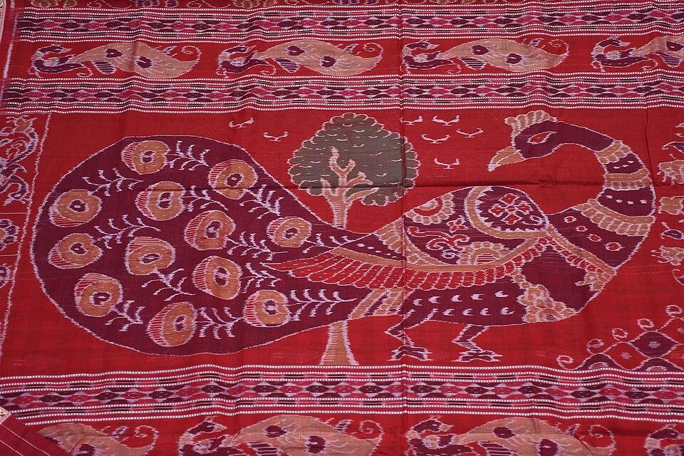
Boudh is also one of the weaving districts of the bandha (ikat) tradition behind the Sambalpuri saree.

Geography and climate

Boudh lies in the middle course of the Mahanadi. Boudh falls in Odisha's Southern revenue division, headquartered at Berhampur. According to the district administration, it is bounded by the Mahanadi and Angul district to the north, Kandhamal to the south, Nayagarh to the east, and the Tel river and Subarnapur district to the west.

In the north-east, the forests around Padmatola form part of the wider Satkosia landscape along the Mahanadi gorge.

FeatureDetail
LocationCentral Odisha, south bank of the Mahanadi
RiversMahanadi (north and west), Tel (west)
Protected areaPadmatola forests, part of the Satkosia landscape
RainfallAbout 1,620 mm a year (Wikipedia)
ClimateHot summers, a June to September monsoon, cool winters

Economy

Boudh is overwhelmingly rural: only about 4.6% of its people lived in towns at the 2011 Census, according to Wikipedia. Farming on the plains of the Mahanadi and Tel is the main livelihood, and handloom weaving in the bandha tradition adds to village incomes.

Climate of Boudh

In Boudh district (at 20.84°N, 84.33°E), the hottest month is May (average highs of 40°C) and the coolest nights come in Jan (16°C). About 1350 mm of rain falls in a year, most of it in the monsoon; Jul is the wettest month.

JanFebMarAprMayJunJulAugSepOctNovDec
Average high (°C)283236404035313031312928
Average low (°C)161923262828262525231916
Rainfall (mm)1613141335189366361238791414
Rainy days1111313222218711

Averages for 1995–2024 at that point (77 m above sea level), from the Open-Meteo historical weather API (ERA5 reanalysis by ECMWF/Copernicus, CC BY 4.0) — modelled values on a ~25 km grid, not station readings from the India Meteorological Department. A rainy day has 2.5 mm or more.

Notable people

Few nationally known figures from Boudh appear in published sources. The people most closely tied to the district's documented history are its rulers:

  • Ananga Bhanja (early 14th century): founder of the long-ruling Bhanja line of Baudh State, adopted from the Keonjhar royal house.
  • Raja Biswambar Dev: ruler who signed the 1804 treaty accepting British sovereignty.
  • Raja Narayan Dev: the last ruler of Baudh State before its merger with Orissa in 1948.

Blocks, sub-districts, panchayats & villages

Choose a block, sub-district or town to see its details and its gram panchayats and villages. Open any village for its own page.

Counts below: Local Government Directory, December 2022 snapshot (LGD villages, which can differ from the district administration's revenue-village count).

Blocks
3
Sub-districts
6
GPs
69
LGD villages
1,187

Community development block

Boudh

Gram panchayats
23
Villages
415
LGD block code
3329
District
Boudh
Open full block page

Villages (…)

All blocks in Boudh

BlockGPsVillagesVillage pop.LiteracyST share
Boudh234151,45,51971.7%11.5%
Harabhanga223621,26,83474.2%12.6%
Kantamal244101,48,38567.0%15.0%

GPs and villages: Local Government Directory (Dec 2022). Village population, literacy and Scheduled Tribe share: sum of the block's villages in Census of India 2011, Primary Census Abstract (village level).

All census sub-districts

Towns (urban local bodies)

Assembly constituencies in Boudh

  • 85KantamalKanhai Charan Danga · BJP
  • 86BoudhSaroj Kumar Pradhan · BJP

Source: Local Government Directory (lgdirectory.gov.in), Government of India — data dump of December 2022 via github.com/planemad/india-local-government-directory. Sub-districts follow the Local Government Directory, which for Odisha uses the Census sub-districts (police-station areas) — these are not the same as revenue tahasils. Boundaries and names change over time; check the district administration for current status.

Frequently asked questions

Why is the district called Boudh?

The name is generally linked to Buddhism. Archaeological finds, including a large Buddha image of about the 8th century in Boudh town, show that the area was a Buddhist centre in the early medieval period.

When was Boudh district formed?

Boudh became a separate district on 2 January 1994, carved out of the former Boudh-Kandhamal district. Before 1948 it was the princely state of Baudh.

What are the main places to visit in Boudh?

The Buddha image and the early medieval Rameswar group of temples in Boudh town, the twin temples of Chari Sambhu at Gandharadi, the Bhairabi temple at Purunakatak and the Padmatola forests of the Satkosia landscape.

How far is Boudh from Bhubaneswar?

According to the Boudh district administration, Boudh is about 230 km from Bhubaneswar by road via Nayagarh, or about 240 km via Angul. The nearest railway station is Rairakhol, about 30 km away.

Which Lok Sabha constituency is Boudh in?

Boudh district is part of the Kandhamal Lok Sabha constituency. It has two assembly seats, Boudh and Kantamal.

Sources & references

  1. 1Boudh district — Wikipedia
  2. 2Boudh District — District Administration, Boudh, Government of Odisha
  3. 3Baudh District: Census 2011 data — Census2011.co.in (compiled from Census of India 2011)
  4. 4Ramesvara Group of Temples at Boudh — Odisha Review, Government of Odisha (October 2010)
  5. 5Buddhist Remains in Western Orissa — Orissa Review, Government of Odisha (May 2005)
  6. 6The Shrine of Goddess Bhairavi of Puruna Katak, Boudh — Orissa Review, Government of Odisha (September 2009)
  7. 7Padmatola and Satakosia Sanctuary — District Administration, Boudh, Government of Odisha
  8. 8Chari Sambhu Temple — Wikipedia

Last reviewed . How we check articles

Report an error