Skip to content

Dhenkanal district

ଢେଙ୍କାନାଳ ଜିଲ୍ଲା

Dhenkanal district in central Odisha: Kapilas temple, Joranda seat of Mahima Dharma, Dhokra craft, Magji sweet (GI) and the story of Baji Rout.

Headquarters
Dhenkanal
Population (2011)
1,192,811
Area
4,452 sq km
Villages
1,210
Literacy (2011)
78.8%
Towns (2011)
5

Dhenkanal (ଢେଙ୍କାନାଳ) is a district in central Odisha with its headquarters at Dhenkanal town. Dhenkanal district is known for the hilltop Shiva temple of Kapilas, Joranda, the main seat of the Mahima Dharma faith, its Dhokra metal craft and the GI-tagged sweet Magji. It is also remembered as the home of the boy martyr Baji Rout.

Dhenkanal lies in the Brahmani valley between the coastal plain and the central Odisha uplands. It covers 4,452 sq km and had a population of 1,192,811 in the 2011 Census, with literacy of 78.76 percent. The area's population has roughly quadrupled since 1901, when it stood at 292,497. Dhenkanal town had 67,414 residents in 2011. About 10 percent of the people lived in towns.

The district grew out of the princely state of Dhenkanal, which merged with India on 1 January 1948. The old state covered much of present-day Angul district as well. Angul and the neighbouring former states of Talcher, Athmallik and Pallahara remained part of Dhenkanal district until 1 April 1993, when Angul became a separate district.

According to the MSME district profile, Dhenkanal has three sub-divisions and eight blocks.
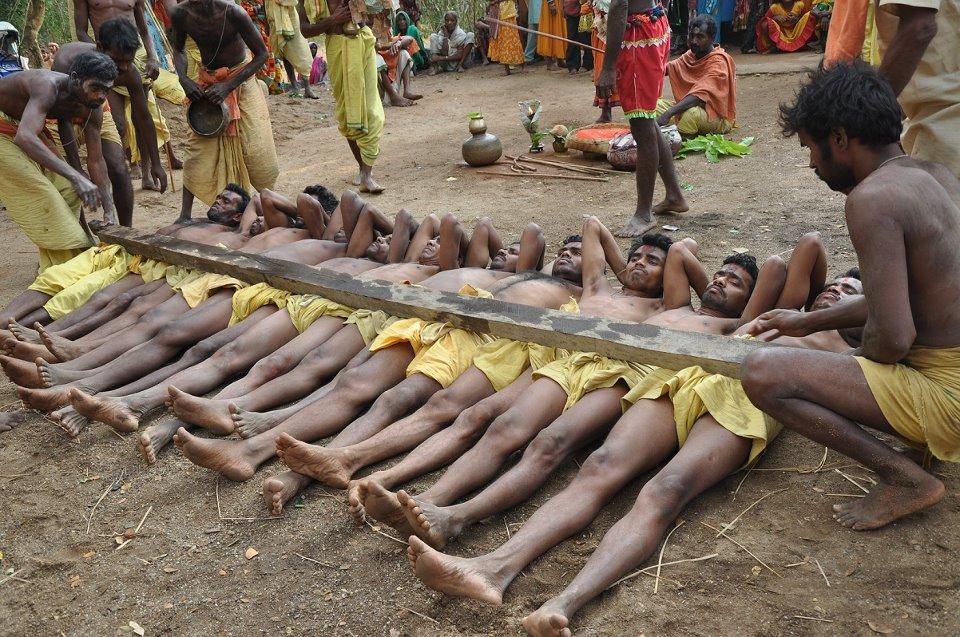
People of Dhenkanal district

Census 2011 counted 11,92,811 people in 2,79,364 households in Dhenkanal district. 9.9% lived in towns, and the literacy rate (age 7 and over) was 78.8%. The census recognised 5 towns in the district.

Population
11,92,811
6,12,593 male · 5,80,218 female
Households
2,79,364
about 4.3 people each
Literacy (age 7+)
78.8%
men 86.2% · women 71.0%
Females per 1,000 males
947
Girls per 1,000 boys (0–6)
877
People per km²
268
  • Rural10,75,305 (90.1%)
  • Urban1,17,506 (9.9%)
Scheduled Castes
2,34,079 (19.6%)
Scheduled Tribes
1,62,056 (13.6%)

What the 4,35,533 workers did

  • Cultivators59,655 (13.7%)
  • Agricultural labourers66,856 (15.4%)
  • Household industry10,672 (2.5%)
  • Other work1,40,155 (32.2%)
  • Marginal workers1,58,195 (36.3%)

Marginal workers worked less than six months of the year.

Source: Census of India 2011, Primary Census Abstract (district, sub-district and town level). Figures are from 2011, the most recent census with published district, town and village figures.

Facilities in the villages of Dhenkanal

How many of the 1,080 inhabited villages of this district had each facility within the village itself, from the Census 2011 Village Directory. Together the 1,207 villages cover 3,365 km², 49% of it sown with crops and 14% forest.

Education

  • Primary school930 of 1,080
  • Middle school558 of 1,080
  • Secondary school295 of 1,080
  • Senior secondary school56 of 1,080
  • Degree college35 of 1,080

Health

  • Primary health centre3 of 1,080
  • Health sub-centre148 of 1,080
  • Anganwadi centre934 of 1,080

Water & power

  • Treated tap water0 of 1,080
  • Hand pump1,067 of 1,080
  • Electricity for homes958 of 1,080

Roads & transport

  • All-weather road786 of 1,080
  • Public bus224 of 1,080
  • Mobile phone coverage966 of 1,080

Services

  • Post office or sub post office261 of 1,080
  • Commercial bank5 of 1,080
  • Ration (PDS) shop631 of 1,080
  • Weekly haat114 of 1,080
Primary schools
1,349
Middle schools
662
Secondary schools
384
Degree colleges
36
Primary health centres
7
Health sub-centres
148

Main crops named by villages: Black Gram (1,080), Paddy (1,068), Pulses (73), Dal (54), Vegetables (54), Sugar Cane (20), Ground Nut (17), Vegetable (14). Handicrafts: Iron Products (4), Bamboo Products (3), Net (3), Bidi (2), Black Smith (2), Bamboo Hand Work (2), Pampad (1), Soil Pots (1).

Source: Census of India 2011, District Census Handbook: Village and Town Directory (Odisha). The facilities were recorded for the 2011 census (reference year 2009 for most items); many places have changed since. Facilities in towns are not included.

Towns of Dhenkanal

3 statutory towns (municipal corporation, municipality, notified area council or industrial township) and 2 census towns — places the census counted as urban but which are governed by gram panchayats.

TownTypePopulationLiteracyWards
DhenkanalMunicipality67,41490.8%23
BhubanNotified Area Council22,20083.6%15
KamakshyanagarNotified Area Council16,81089.6%12
SarangaCensus town6,42692.1%–
IndipurCensus town4,65688.1%–

Population of the town itself; for towns with outgrowths, the town page also gives the figure including them. Ward counts are the census wards of 2011.

Census sub-districts: town and country

Sub-districtPopulationRuralUrbanLiteracy
Parajang1,64,4821,58,0566,42677.1%
Kamakshyanagar1,17,0961,00,28616,81081.5%
Kankadahad61,22261,222067.8%
Bhuban1,01,05178,85122,20080.3%
Gandia1,04,4421,04,442076.7%
Nihalprasad53,45253,452077.2%
Tumusingha53,80253,802078.6%
Motunga62,01462,014081.4%
Bhusan Steel Limited26,82126,821081.3%
Balimi47,59247,592075.7%
Hindol44,15944,159073.1%
Rasol73,85073,850076.9%
Dhenkanal Sadar2,82,8282,10,75872,07082.4%

Odisha's census sub-districts are police-station areas, not revenue tahasils.

History

According to the district administration, the name Dhenkanal is commonly traced to Dhenka, a Savara chief who once ruled the area. Little is known of the earliest period. The district administration links the region in turn to the Satavahanas (2nd century CE), the Guptas (3rd–4th century), the Bhaumakaras (6th–7th century) and the Sulki dynasty (until the 9th century).

The Kapilas temple was built in 1246 CE by the Eastern Ganga king Narasimha Deva I, according to an inscription at the temple.

The princely line of Dhenkanal began in 1530, when Hari Singh Vidyadhar, a commander of the Gajapati king, took control of the area. Hari Singh Vidyadhar ruled until 1594, and the district administration counts eighteen kings in the line that followed him over about four centuries. The last ruler was Shankar Pratap Singh Dev Mahendra, who reigned from 1918.

In the 19th century, Mahima Gosain, founder of the Mahima Dharma movement, made Joranda his base. According to Wikipedia, he entered samadhi there in 1876. Joranda has remained the faith's main seat (gadi) ever since.

In 1938 the Dhenkanal Praja Mandal, a people's movement led by Harmohan Patnaik and others, rose against heavy taxes and forced labour under the ruler. During this agitation, on the night of 10–11 October 1938, police shot dead 12-year-old Baji Rout at the Nilakanthapur ghat on the Brahmani after he refused to ferry them across. Others were killed with him. See Baji Rout.

The Odia poet Sachi Routray wrote the poem Baji Rout in 1938, and the boy's death became one of the best-remembered episodes of the Praja Mandal struggle.

In 1892 the princely state covered about 3,789 sq km, according to Wikipedia. Dhenkanal State merged with India on 1 January 1948. Angul was separated in 1993, giving the district its present shape.

Places to visit

Kapilas

Kapilas hill, about 26 km from Dhenkanal town, is topped by the temple of Chandrasekhar (Shiva), built in 1246 CE. Pilgrims climb 1,352 steps or take the road. Sources differ on the height: the district administration gives the peak as 457 m, while other accounts put the temple at about 2,239 ft. The older Vishwanath shrine, known as Budha Linga, stands nearby, and tradition identifies the hill as the hermitage of the sage Kapila. Some regard it as a second Kailash of Shiva. The main tower is about 60 ft high, and two sacred tanks, Payamrta Kunda and Marichi Kunda, lie within the temple grounds. A science park run near the hill offers outdoor exhibits.

Joranda

Joranda, about 24 km north of Dhenkanal town where the villages of Joranda, Natima and Patna meet, is the main seat of Mahima Dharma and the samadhi place of Mahima Gosain. Followers worship a formless supreme being, and there are no idols. The annual Joranda Mela (Magha Mela) around Magha Purnima draws ascetics and devotees from Odisha and neighbouring states. The poet-saint Bhima Bhoi was the movement's best-known voice.

Saptasajya

A hill shrine about 11 km from Dhenkanal, with a Raghunath (Rama) temple complex. A motor road has reached the village since 1982, and shrines to Annapurna, Kali and Surya Narayan were added between 1982 and 1990. Local tradition says the Pandavas spent part of their exile here. Other accounts explain the name as the seven hills, or the hermitages of the seven sages.

Dhenkanal Palace

The former royal palace reflects the history of the princely state and is listed by Odisha Tourism among the district's main sights.

Other sites

  • Kualo, about 72 km from Dhenkanal, has a group of temples dedicated to Kanakeswar.
  • Saranga, about 67 km away, has an ancient sculpture of Vishnu carved on the rocky bed of a river.
  • Dandadhar, about 67 km away, is an irrigation dam on the Ramial river, popular for outings.
  • The science centre at Dhenkanal is one of the units of the National Council of Science Museums.

How to reach

  • By air: Biju Patnaik International Airport, Bhubaneswar, about 80 km away, according to Odisha Tourism.
  • By rail: Dhenkanal station is on the Cuttack–Sambalpur line, with direct trains to Cuttack, Bhubaneswar and western Odisha.
  • By road: Highways link Dhenkanal with Cuttack and Bhubaneswar to the south-east and Angul to the west, with frequent buses.

Odisha Tourism suggests one to two days for the district and October to March as the best season. See also how to reach Odisha.

Temples (11)

  • Annakoteswar Temple
  • Ashtashambhu Temple · ଅଷ୍ଟଶମ୍ଭୁ ପୀଠ
  • Balaram Temple, Dhenkanal · ବଳରାମ ମନ୍ଦିର, ଢେଙ୍କାନାଳ
  • Jagannatha Temple
  • Kanakesvara Mahadev Temple
  • Kapilash Temple · କପିଳାସ ଶିବ ମନ୍ଦିର
  • Kapileswar Mahadev Temple
  • Nadara Ramachandi Temple
  • Sidhesvara Temple
  • Somnatha Temple
  • Yajnesvara Temple

Photos and map links in the temple directory. Today's tithi, sunrise and Rahu Kala here.

Protected monuments (4)

Monuments of National Importance protected by the Archaeological Survey of India. All of Odisha.

Railway stations

11 stations and 4 halts inside the district, as mapped on OpenStreetMap; some on new lines may not yet have regular trains.

Culture and festivals

The Joranda Mela is the district's best-known gathering, when Mahima Dharma ascetics and lay followers gather at the Mahima Gadi and sacred fires are lit.

Dhenkanal is one of Odisha's main centres of Dhokra lost-wax brass casting. OrissaPOST reported in 2022 that about 120 artisans worked in the craft at Nabajibanpur in Sadeibereni, under Saptasajya panchayat. A crafts village built there in 2019 for about Rs 5 crore was waiting to open. The MSME profile also lists brass and bell-metal utensil units. Dhokra from Odisha does not hold a GI tag.

Odia is spoken by about 96 percent of people (2011). Small Munda, Santal and Juang communities also live in the district.

Food

  • Dhenkanal Magji: a sweet made from buffalo-milk chhena (cottage cheese), registered as a Geographical Indication in 2024. See GI tags of Odisha.
  • Odisha Tourism's Dhenkanal guide also mentions Dhenkanal bara and ghuguni, alongside everyday pakhala bhata and dalma.

Geography and climate

Dhenkanal is bordered by Kendujhar and Angul to the north, Jajpur to the east, Cuttack to the south and Angul to the west. The Brahmani is the main river; the Nilakanthapur ghat, where Baji Rout was killed, is on its bank.

The landscape is a mix of farmland and low, forested hills, including the Kapilas range north-east of the town. The MSME profile records about 1,738 sq km of forest, which supplies kendu leaves, bamboo and timber.

FeatureDetail
Area (2011 Census)4,452 sq km
Main riverBrahmani
Forest areaAbout 1,738 sq km (MSME profile, 2011–12)
Average annual rainfallAbout 1,421 mm
ClimateHot summers, monsoon June–October, mild winters

Economy

Agriculture and forest produce support most rural households. The MSME profile (2011–12) records small-scale working of chromite, quartz and fire clay. Its list of large units includes Bhushan Steel at Meramandali, Navabharat Ferro Alloys and Shakti Sugars. The Meramandali steel plant, set up by Bhushan Steel, passed to Tata Steel in 2018 and is now run as Tata Steel's Meramandali works. Small enterprises include engineering units, fly-ash brick makers, brass and bell-metal workshops, and a garment cluster at Baulapur.

Dhenkanal is also home to a campus of the Indian Institute of Mass Communication, which Wikipedia describes as the only institute in Odisha for the study of journalism and mass communication.

Climate of Dhenkanal

In Dhenkanal district (at 20.67°N, 85.59°E), the hottest month is Apr (average highs of 38°C) and the coolest nights come in Jan (16°C). About 1500 mm of rain falls in a year, most of it in the monsoon; Jul is the wettest month.

JanFebMarAprMayJunJulAugSepOctNovDec
Average high (°C)273136383834313131312927
Average low (°C)161822252727262525231916
Rainfall (mm)16162627742113693472501222318
Rainy days11325162425211021

Averages for 1995–2024 at that point (56 m above sea level), from the Open-Meteo historical weather API (ERA5 reanalysis by ECMWF/Copernicus, CC BY 4.0) — modelled values on a ~25 km grid, not station readings from the India Meteorological Department. A rainy day has 2.5 mm or more.

Notable people

  • Baji Rout (1926–1938), boatman of Nilakanthapur, killed by police in 1938 and widely remembered as India's youngest martyr. See Baji Rout.
  • Sarangadhar Das (1886–1957), born in Dhenkanal State, general secretary of the Orissa States People's Conference (1937–1946), member of the Constituent Assembly and of the first Lok Sabha.
  • Kalpana Dash (1966–2019), born in Dhenkanal, the first Odia climber to reach the summit of Mount Everest (21 May 2008). She died on Everest in May 2019 while descending after a second summit.

Blocks, sub-districts, panchayats & villages

Choose a block, sub-district or town to see its details and its gram panchayats and villages. Open any village for its own page.

Counts below: Local Government Directory, December 2022 snapshot (LGD villages, which can differ from the district administration's revenue-village count).

Blocks
8
Sub-districts
13
GPs
212
LGD villages
1,210

Community development block

Bhuban

Gram panchayats
18
Villages
135
LGD block code
3349
District
Dhenkanal
Open full block page

Villages (…)

All blocks in Dhenkanal

BlockGPsVillagesVillage pop.LiteracyST share
Bhuban181351,02,26980.3%10.3%
Dhenkanal Sadar301631,52,93278.9%13.2%
Gondia291951,52,18076.6%16.6%
Hindol351851,77,94375.8%6.9%
Kamakhyanagar221441,13,86079.0%17.6%
Kankada Had211401,08,71771.0%41.6%
Odapada281501,38,82681.7%8.2%
Parjang29981,30,97477.3%8.8%

GPs and villages: Local Government Directory (Dec 2022). Village population, literacy and Scheduled Tribe share: sum of the block's villages in Census of India 2011, Primary Census Abstract (village level).

All census sub-districts

Towns (urban local bodies)

  • Bhuban · Notified Area Council
  • Dhenkanal · Municipality
  • Hindol · Notified Area Council · no matching Census 2011 town
  • Kamakhyanagar · Notified Area Council

Assembly constituencies in Dhenkanal

Source: Local Government Directory (lgdirectory.gov.in), Government of India — data dump of December 2022 via github.com/planemad/india-local-government-directory. Sub-districts follow the Local Government Directory, which for Odisha uses the Census sub-districts (police-station areas) — these are not the same as revenue tahasils. Boundaries and names change over time; check the district administration for current status.

Frequently asked questions

What is Dhenkanal famous for?

Dhenkanal is known for the Kapilas Shiva temple, Joranda (the main seat of Mahima Dharma), Dhokra metal craft at Sadeibereni, the GI-tagged Magji sweet, and as the home of the boy martyr Baji Rout.

How many steps are there to Kapilas temple?

The Chandrasekhar temple on Kapilas hill can be reached by a flight of 1,352 steps or by road. The hill is about 26 km from Dhenkanal town.

When is the Joranda Mela held?

The Joranda Mela, or Magha Mela, is held at the Mahima Gadi in Joranda around Magha Purnima, the full moon of the month of Magha, which falls in January or February.

How did Dhenkanal get its name?

According to the district administration, Dhenkanal is commonly believed to be named after a Savara chief called Dhenka who once ruled the area.

How far is Dhenkanal from Bhubaneswar?

Odisha Tourism gives the distance from Biju Patnaik International Airport, Bhubaneswar, as about 80 km. Dhenkanal is also on the Cuttack–Sambalpur railway line.

Sources & references

  1. 1Dhenkanal District: Census 2011 data — Census2011.co.in (compiled from Census of India 2011)
  2. 2History — District Administration, Dhenkanal, Government of Odisha
  3. 3Brief Industrial Profile of Dhenkanal District — MSME-Development Institute, Ministry of MSME, Government of India
  4. 4Dhenkanal — Odisha Tourism, Government of Odisha
  5. 5Built at whopping Rs 5 crore, Dhenkanal dokra crafts village to be functional soon — OrissaPOST
  6. 6Kapilash Temple — Wikipedia
  7. 7Dhenkanal State — Wikipedia
  8. 8Dhenkanal district — Wikipedia

Last reviewed . How we check articles

Report an error