Skip to content

Ganjam district

ଗଞ୍ଜାମ ଜିଲ୍ଲା

Ganjam is a coastal district of southern Odisha, HQ Chhatrapur, home to Berhampur silk, Gopalpur beach, Tara Tarini and the Rushikulya turtle coast.

Headquarters
Chhatrapur
Population (2011)
3,529,031
Area
8,206 sq km
Villages
3,229
Literacy (2011)
71.1%
Towns (2011)
39

Ganjam (ଗଞ୍ଜାମ) is a coastal district in southern Odisha, lying along the Bay of Bengal between Chilika Lake in the north and the Andhra Pradesh border in the south. It is the most populous district of Odisha, with 3,529,031 people at the 2011 Census, and its administrative headquarters is Chhatrapur. Its largest city, Brahmapur (Berhampur), is the commercial centre of southern Odisha and is known as the "Silk City" for its Berhampur Patta sarees.

According to the district administration, Ganjam takes its name from the old township and European fort of Ganjam on the northern bank of the Rushikulya river. Other derivations have also been suggested, including the ancient name Kongoda and the Persian word ganj, meaning a granary or market.

Ganjam district came into existence on 1 April 1936, when it was separated from the Madras Presidency and joined to the new province of Orissa. It is one of the oldest administrative units of the state. On 2 October 1992 its south-western part was carved out to form Gajapati district.

The district covers 8,206 sq km by the Census figure (the district administration gives 8,070.6 sq km). It has three sub-divisions, Chhatrapur, Brahmapur and Bhanjanagar. Odia is the main language, and Telugu is spoken by about 7% of residents as a first language, reflecting the long border with Andhra Pradesh. The local speech, Ganjami, is one of the main Odia dialects.
People of Ganjam district

Census 2011 counted 35,29,031 people in 7,58,267 households in Ganjam district. 21.8% lived in towns, and the literacy rate (age 7 and over) was 71.1%. The census recognised 39 towns in the district.

Population
35,29,031
17,79,218 male · 17,49,813 female
Households
7,58,267
about 4.7 people each
Literacy (age 7+)
71.1%
men 81.0% · women 61.1%
Females per 1,000 males
983
Girls per 1,000 boys (0–6)
908
People per km²
430
  • Rural27,61,030 (78.2%)
  • Urban7,68,001 (21.8%)
Scheduled Castes
6,88,235 (19.5%)
Scheduled Tribes
1,18,928 (3.4%)

What the 15,01,772 workers did

  • Cultivators2,34,066 (15.6%)
  • Agricultural labourers1,85,015 (12.3%)
  • Household industry34,534 (2.3%)
  • Other work4,47,129 (29.8%)
  • Marginal workers6,01,028 (40.0%)

Marginal workers worked less than six months of the year.

Source: Census of India 2011, Primary Census Abstract (district, sub-district and town level). Figures are from 2011, the most recent census with published district, town and village figures.

Facilities in the villages of Ganjam

How many of the 2,783 inhabited villages of this district had each facility within the village itself, from the Census 2011 Village Directory. Together the 3,195 villages cover 5,738 km², 58% of it sown with crops and 8% forest.

Education

  • Primary school2,366 of 2,783
  • Middle school1,154 of 2,783
  • Secondary school541 of 2,783
  • Senior secondary school88 of 2,783
  • Degree college49 of 2,783

Health

  • Primary health centre9 of 2,783
  • Health sub-centre391 of 2,783
  • Anganwadi centre2,207 of 2,783

Water & power

  • Treated tap water0 of 2,783
  • Hand pump2,600 of 2,783
  • Electricity for homes2,489 of 2,783

Roads & transport

  • All-weather road1,527 of 2,783
  • Public bus388 of 2,783
  • Mobile phone coverage2,524 of 2,783

Services

  • Post office or sub post office559 of 2,783
  • Commercial bank18 of 2,783
  • Ration (PDS) shop858 of 2,783
  • Weekly haat168 of 2,783
Primary schools
3,410
Middle schools
1,352
Secondary schools
756
Degree colleges
55
Primary health centres
16
Health sub-centres
391

Main crops named by villages: Paddy (2,473), Pulses (901), Ragi (466), Vegetables (192), Vegetable (166), Gram (145), Sugarcane (110), Moong (91). Handicrafts: Bamboo Products (5), Furnitures (4), Bamboo Work (2), Earthern Pots (2), Bricks (2), Pottery (1), Saree (1), Cloth (1).

Source: Census of India 2011, District Census Handbook: Village and Town Directory (Odisha). The facilities were recorded for the 2011 census (reference year 2009 for most items); many places have changed since. Facilities in towns are not included.

Towns of Ganjam

18 statutory towns (municipal corporation, municipality, notified area council or industrial township) and 21 census towns — places the census counted as urban but which are governed by gram panchayats.

TownTypePopulationLiteracyWards
BrahmapurMunicipal Corporation3,56,59889.3%37
HinjilicutNotified Area Council24,67181.6%21
PolasaraNotified Area Council23,11978.6%19
ChhatrapurNotified Area Council22,02789.8%14
AsikaNotified Area Council21,42885.8%17
BhanjanagarNotified Area Council20,48289.3%15
KabisurjyanagarNotified Area Council17,43080.7%18
LochapadaCensus town16,37789.5%–
PurusottampurNotified Area Council15,36678.2%14
BugudaNotified Area Council15,17683.3%13
SuradaNotified Area Council14,86777.7%11
KodalaNotified Area Council13,96570.8%13
DigapahandiNotified Area Council13,19078.4%11
KhalikoteNotified Area Council13,02282.9%12
RambhaNotified Area Council12,11175.5%13
GanjamNotified Area Council11,74785.3%12
ChikitiNotified Area Council11,64575.7%12
BellagunthaNotified Area Council11,29780.8%13
BhabinipurCensus town10,41185.4%–
SuralaCensus town8,25861.7%–
ArjyapalliCensus town8,00140.3%–
SuvaniCensus town7,99353.7%–
KukudakhandiCensus town7,36172.8%–
GopalpurNotified Area Council7,22161.8%11
LalsingiCensus town7,07887.5%–
BadagadaCensus town6,98270.3%–
SheragadaCensus town6,65379.8%–
AgastinuaganCensus town6,41137.1%–
GolabandhaCensus town6,23282.1%–
PatharCensus town6,07274.2%–
PatrapurCensus town6,05973.0%–
KulladaCensus town5,64578.5%–
BadakodandaCensus town5,13772.3%–
PalurgadaCensus town5,01974.3%–
MakundapurCensus town4,98384.9%–
BorigamCensus town4,85570.4%–
PitalaCensus town4,45875.2%–
VenkatraipurCensus town4,40153.9%–
MundamaraiCensus town4,25374.8%–

Population of the town itself; for towns with outgrowths, the town page also gives the figure including them. Ward counts are the census wards of 2011.

Census sub-districts: town and country

Sub-districtPopulationRuralUrbanLiteracy
Tarasingi84,98179,3365,64570.8%
Buguda1,36,2121,21,03615,17673.8%
Jagannath Prasad79,90179,901077.8%
Bhanjanagar1,77,2351,33,24143,99477.2%
Gangapur1,14,4801,14,480074.5%
Surada87,68472,81714,86763.5%
Badagada1,25,8361,18,8546,98258.5%
Asika1,43,7701,17,35926,41176.3%
Dharakote57,52853,2754,25372.0%
Kabisuryanagar1,76,6401,59,21017,43072.0%
Polasara1,36,7031,13,58423,11969.9%
Kodala1,51,3181,37,35313,96568.0%
Khalikote1,46,7131,27,61919,09468.5%
Rambha95,65978,52917,13066.6%
Chhatrapur94,68372,65622,02773.6%
Ganjam45,24327,08518,15870.0%
Chamakhandi48,23648,236069.4%
Arjyapalli Marine8,00108,00140.3%
Purusottampur1,59,8691,44,50315,36667.5%
Hinjili1,62,7791,33,65029,12971.7%
Patapur1,33,5741,33,574061.9%
Seragad66,22459,5716,65369.4%
Brahmapur Sadar1,43,7631,04,75939,00471.6%
Gopalpur67,95750,10317,85469.4%
Golanthara1,47,5821,31,33116,25162.6%
Digapahandi1,37,2391,24,04913,19064.2%
Nuagaon1,14,4361,02,79111,64565.9%
Jarada1,15,2011,09,1426,05960.7%
Brahmapur (M.Corp.)3,56,59803,56,59889.3%
Ramagiri12,98612,986035.5%

Odisha's census sub-districts are police-station areas, not revenue tahasils.

History

Ganjam formed part of ancient Dakshina Kalinga (southern Kalinga). After the Kalinga War of about 261 BCE, the Mauryan emperor Ashoka had his edicts inscribed at Jaugada on the Rushikulya, about 35 km north-west of Brahmapur. Jaugada was a fortified Mauryan provincial centre. Its rock carries Major Rock Edicts 1 to 10 and 14, plus the two Separate Edicts addressed to the people of Kalinga, dated to about 250 BCE. The Archaeological Survey of India excavated the site in 1956.

By the 7th century CE the region was known as Kongoda. It later came under the Eastern Gangas and the Gajapati kings of Odisha, and many small hill and coastal estates grew up under local chiefs. Among them was the Bhanja house of Ghumusar, into which the poet Upendra Bhanja was born.

In the 18th century the French commander Bussy briefly held the area (about 1757–1759) before the English defeated the French in 1759. The district collector's office dates from 1794. Ganjam was then governed as part of the Madras Presidency. In the 1830s the Ghumusar hill tracts saw armed resistance to Company rule. After the death of the Ghumusar ruler Dhananjaya Bhanja in 1835, the Kandha leader Dora Bisoi led the struggle until his capture in 1837. In the following years British officers such as Samuel Charters Macpherson worked in these hills to suppress the meriah sacrifice.

The movement for a separate Odia province drew strong support from Ganjam's Odia-speaking population. When Orissa province was formed on 1 April 1936 (now marked as Utkal Divas), most of Ganjam was transferred to it.

Places to visit

Gopalpur-on-Sea

Gopalpur is a small seaside town about 16 km from Brahmapur. It was once a busy port. Today it is known for a quiet, east-facing beach, casuarina groves, an old lighthouse and colonial-era buildings. Odisha Tourism advises against swimming because the sea is rough. See the Gopalpur-on-Sea travel guide.

Tara Tarini Temple

The twin goddesses Tara and Tarini are worshipped on the Purnagiri (Kumari) hills above the Rushikulya, about 30 km from Brahmapur. The shrine is revered as one of the four Adi Shakti Pithas. Odisha Tourism notes that it can be reached by road, by ropeway or by climbing 999 steps. The largest crowds come on the Tuesdays of the month of Chaitra (March–April).

Rushikulya rookery

The beaches near the mouth of the Rushikulya are a mass-nesting site (arribada) for olive ridley turtles, usually in February–March. Nesting stretches are protected by the forest department, so visitors should follow local rules.

Jaugada

The ruined Mauryan fort at Jaugada, near Purushottampur, holds one of Ashoka's two sets of Kalinga edicts in Odisha; the other is at Dhauli near Bhubaneswar.

Taptapani

Taptapani is a sulphurous hot spring in the forested hills of western Ganjam, near the Gajapati border. Visitors and pilgrims bathe in the warm water before praying at the nearby Kandimata shrine. The water is traditionally believed to have healing properties. Odisha Tourism runs a guest house (Panthanivas) here.

Biranchi Narayan Temple, Buguda

This Sun temple at Buguda is often called the "Wooden Konark" because its deity is carved in wood. According to Wikipedia, the temple faces west rather than east and was renovated in 1790 under the Bhanja king Srikara Bhanja. The district administration lists it among Ganjam's main attractions.

Rambha and southern Chilika

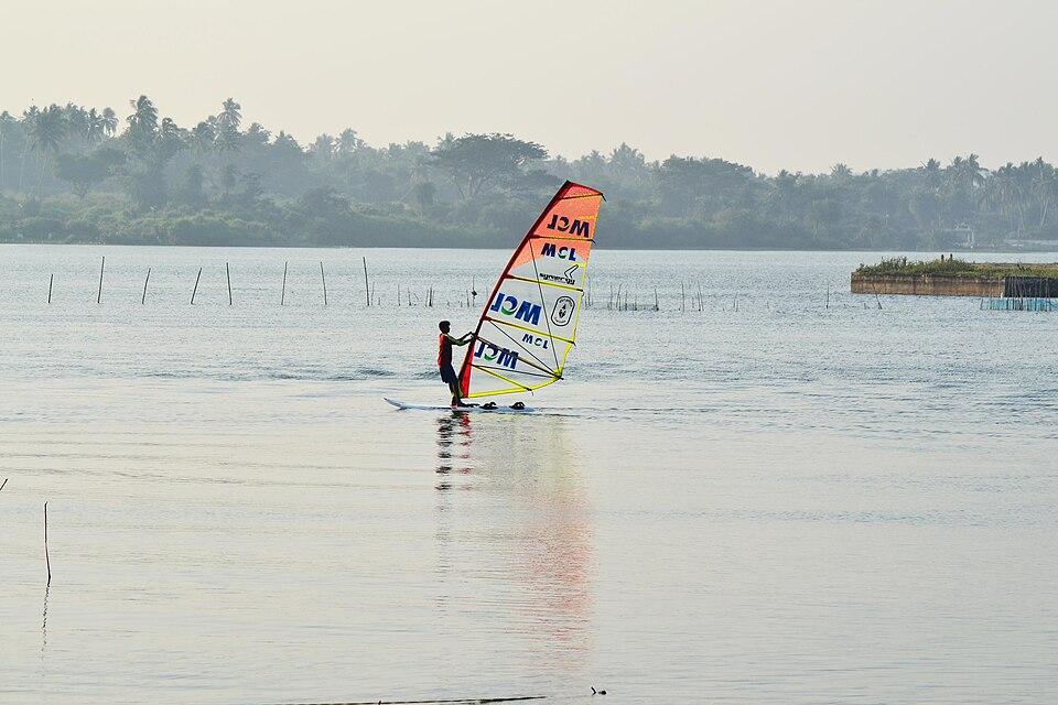
Rambha, on the southern shore of Chilika, is a quieter base for boat trips to the lake's southern islands. See the Chilika Lake travel guide.

How to reach

  • By air: The nearest major airport is Biju Patnaik International Airport, Bhubaneswar. Brahmapur is roughly 170 km away by road, and Odisha Tourism gives Gopalpur as about 174 km from Bhubaneswar. A small airstrip at Rangeilunda near Brahmapur has had limited regional flights to Bhubaneswar since March 2023; check current services before planning.
  • By rail: Brahmapur (Berhampur) station, on the Howrah–Chennai main line, is the main railhead. Stations such as Chhatrapur and Rambha are on the same line.
  • By road: NH-16 runs along the coast through the district. NH-59 links Brahmapur with the interior towards Aska and Bhanjanagar, and NH-516 also serves the region. Regular buses connect Brahmapur with Bhubaneswar, Cuttack and southern Odisha.

For other districts, see the list of Odisha districts.

Temples (15)

  • Biranchinarayan Temple, Buguda · ବିରଞ୍ଚି ନାରାୟଣ ମନ୍ଦିର, ବୁଗୁଡ଼ା
  • Biranchinarayana Temple
  • Gangadharaswami temple
  • Jagannath Temple, Dharakote · ଜଗନ୍ନାଥ ମନ୍ଦିର, ଧରାକୋଟ
  • Jagannatha Temple
  • Jagannatha Temple
  • Jagdiswaraswami temple
  • Mahuri Kalua · ମହୁରୀ କାଳୁଆ
  • Ram Temple, Junia · ରାମ ମନ୍ଦିର, ଜୁଣିଆ
  • Ramapada Temple
  • Shankulai Temple · ଶାଙ୍କୁଳାଇ ମନ୍ଦିର
  • Siddha Bhairavi · ସିଦ୍ଧ ଭୈରବୀ
  • Tara Tarini Temple · ତାରାତାରିଣୀ ମନ୍ଦିର
  • Taratarini Temple · ତାରାତାରିଣୀ ମନ୍ଦିର
  • Uttaresvara Temple

Photos and map links in the temple directory. Today's tithi, sunrise and Rahu Kala here.

Protected monuments (3)

Monuments of National Importance protected by the Archaeological Survey of India. All of Odisha.

Railway stations

10 stations and 3 halts inside the district, as mapped on OpenStreetMap; some on new lines may not yet have regular trains.

Culture and festivals

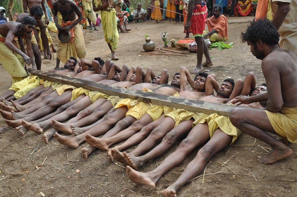
Ganjam has a lively folk culture. Danda Nacha, the penitential dance-ritual of the Chaitra month devoted mainly to Shiva, is strongest in Ganjam. It ends on Maha Vishuva Sankranti, known locally as Meru Sankranti (see Pana Sankranti).

In Brahmapur, the biennial Thakurani Jatra of Goddess Budhi Thakurani is the city's biggest festival. Historians trace the cult to around 1672, when the town grew up with the Dera weaver community. The Odisha government lists it among the state's official festivals. Bagha Nacha (the tiger dance) is a highlight of the festival.

Prahallada Nataka is a traditional musical play from Ganjam's former zamindari courts. Its best-known text was written in the mid-19th century under Raja Ramakrushna Chhotaraya of Jalantara, largely by the poet-musician Gourahari Parichha. A full performance can last all night. Other festivals listed by the district administration include Dola Yatra, the Tara Tarini Mela, Durga Puja, Ratha Yatra and Makar Sankranti.

Ganjam's crafts and products include four registered Geographical Indications (see Odisha GI tags):

  • Berhampur Patta (Phoda Kumbha) saree and joda, silk weaves with temple-pattern borders made by Brahmapur's weavers.
  • Bomkai saree, named after Bomkai village in Ganjam and also woven in Subarnapur.
  • Ganjam Kewda flower and Ganjam Kewda rooh, the screwpine flower and its distilled essence, used in perfumery and flavouring.

Food

Brahmapur is sometimes called the "food capital" of Odisha for its busy street-food scene. Its wholesale mango market is one of the largest in India. Coastal towns such as Gopalpur are known for fresh seafood. Kewda water distilled in Ganjam is used to scent sweets and drinks across India. Cashew processing is a local industry, centred on a cluster at Rambha.

Geography and climate

Ganjam has two broad landscapes. In the east is a fertile coastal plain, and in the west are hills and tablelands of the Eastern Ghats. The district borders Khordha and Nayagarh to the north, Kandhamal to the north-west, Gajapati to the south-west, Andhra Pradesh to the south and the Bay of Bengal to the east.

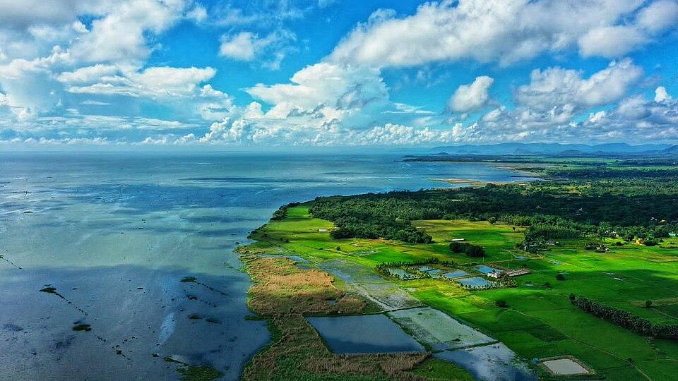
The main river is the Rushikulya. It rises in the Rushimala hills near Daringbadi in Kandhamal, flows about 165 km through Kandhamal and Ganjam, and meets the sea at Puruna Bandha without forming a delta. Its tributaries include the Baghua, Dhanei and Badanadi. The southern part of Chilika Lake, around Rambha, lies within Ganjam.

The coast is one of India's major nesting grounds for olive ridley sea turtles. Large-scale nesting near the Rushikulya mouth was first recorded in 1993. In February 2025 Down To Earth reported that 698,718 turtles nested there over eight days, a record for the site.

FeatureDetail
Area8,206 sq km (Census 2011)
Main riverRushikulya
LandscapeCoastal plain in the east; Eastern Ghats hills in the west
CoastlineBay of Bengal, including part of Chilika Lake
ClimateMild on the coast; cool December–February, hot March–May, monsoon June–September
RainfallSources give an annual average of roughly 1,300–1,450 mm

The district administration describes the coastal climate as equable through the year, with the cold season from December to February and the hot season from March to May.

Economy

Agriculture is the main occupation. The district administration lists paddy, groundnut, sugarcane, oilseeds, ragi, mung and biri among the major crops. According to the district administration:

  • About 150 Kewda essence units employ some 3,000 workers, and the Ganjam Kewra Development Trust holds the GI registration.
  • About 76 cashew-processing units form the Jagannath Cashew Cluster, headquartered at Rambha.
  • Granite cutting and polishing units work in the Kukudakhandi, Digapahandi and Rangeilunda blocks.
  • The district also has rice mills, an Ayurvedic medicine cluster, coir training at Golabandha and salt production around Huma.

The beach sands near Chhatrapur are mined by IREL (India) Limited at its Odisha Sands Complex (OSCOM), next to Gopalpur port. The plant produces ilmenite, rutile, zircon, sillimanite and garnet. Gopalpur also has a deep-water port. Fisheries and tourism support coastal villages, while Brahmapur is a regional hub for trade, education (Berhampur University) and health care.

Climate of Ganjam

In Ganjam district (at 19.39°N, 84.69°E), the hottest month is May (average highs of 38°C) and the coolest nights come in Jan (15°C). About 1370 mm of rain falls in a year, most of it in the monsoon; Jul is the wettest month.

JanFebMarAprMayJunJulAugSepOctNovDec
Average high (°C)273135373835323131302927
Average low (°C)151821252727262525231916
Rainfall (mm)15151917541873042862441505231
Rainy days11223132021191132

Averages for 1995–2024 at that point (50 m above sea level), from the Open-Meteo historical weather API (ERA5 reanalysis by ECMWF/Copernicus, CC BY 4.0) — modelled values on a ~25 km grid, not station readings from the India Meteorological Department. A rainy day has 2.5 mm or more.

Notable people

  • Upendra Bhanja: celebrated poet of the late 17th and early 18th centuries, known by the later title Kabi Samrat. He was born at Kulada in the Ghumusar estate, and the town of Bhanjanagar is named after him.
  • V. V. Giri: fourth President of India, born in Berhampur on 10 August 1894.
  • Sanjukta Panigrahi: Odissi dancer, born in Berhampur in 1944 and awarded the Padma Shri in 1975.
  • Biju Patnaik: the former Chief Minister was born in Cuttack, but his parents lived at Ghumusar Nuagam near Bellaguntha in Ganjam. He represented Aska in the Lok Sabha from 1996 to 1997.

Blocks, sub-districts, panchayats & villages

Choose a block, sub-district or town to see its details and its gram panchayats and villages. Open any village for its own page.

Counts below: Local Government Directory, December 2022 snapshot (LGD villages, which can differ from the district administration's revenue-village count).

Blocks
22
Sub-districts
29
GPs
503
LGD villages
3,229

Community development block

Aska

Gram panchayats
27
Villages
113
LGD block code
3364
District
Ganjam
Open full block page

Villages (…)

All blocks in Ganjam

BlockGPsVillagesVillage pop.LiteracyST share
Aska271131,39,14974.4%0.7%
Beguniapada231831,35,06366.8%3.5%
Bellaguntha18921,13,02878.0%0.6%
Bhanjanagar221431,20,46772.4%10.1%
Buguda21981,14,27272.5%1.8%
Chatrapur18801,21,33968.6%0.4%
Chikiti1713788,16063.2%3.8%
Dharakote182061,03,99663.8%8.7%
Digapahandi252361,48,06062.5%6.6%
Ganjam1511585,41667.8%0.5%
Hinjilicut21521,14,43870.6%0.2%
Jagannathprasad251501,32,18174.7%5.4%
Kabisuryanagar21741,14,35471.3%0.3%
Khallikote292181,60,72466.2%3.7%
Kukudakhandi221001,18,72064.7%5.5%
Patrapur233561,22,65257.6%14.6%
Polosara261371,33,52669.2%3.1%
Purushottampur26961,43,15666.3%0.2%
Rangeilunda32831,41,90967.8%0.3%
Sanakhemundi261651,55,25863.1%4.8%
Sheragada221131,19,23968.3%1.1%
Surada262811,35,92359.2%12.4%

GPs and villages: Local Government Directory (Dec 2022). Village population, literacy and Scheduled Tribe share: sum of the block's villages in Census of India 2011, Primary Census Abstract (village level).

All census sub-districts

Towns (urban local bodies)

Assembly constituencies in Ganjam

Source: Local Government Directory (lgdirectory.gov.in), Government of India — data dump of December 2022 via github.com/planemad/india-local-government-directory. Sub-districts follow the Local Government Directory, which for Odisha uses the Census sub-districts (police-station areas) — these are not the same as revenue tahasils. Boundaries and names change over time; check the district administration for current status.

Frequently asked questions

What is the headquarters of Ganjam district?

The district headquarters is Chhatrapur. The largest city and main commercial centre of the district is Brahmapur (Berhampur).

When was Ganjam district formed?

According to the district administration, Ganjam district came into existence on 1 April 1936, when it was transferred from the Madras Presidency to the newly formed Orissa province. Gajapati district was carved out of it on 2 October 1992.

What is Ganjam district famous for?

Ganjam is known for Berhampur's silk (Berhampur Patta) sarees, Gopalpur beach, the Tara Tarini hill shrine, the Ashokan edicts at Jaugada, Kewda (screwpine) essence and the mass nesting of olive ridley turtles at the mouth of the Rushikulya.

What is the population of Ganjam district?

The 2011 Census counted 3,529,031 people, the largest population of any district in Odisha.

How far is Berhampur from Bhubaneswar?

Brahmapur (Berhampur) is roughly 170 km by road from Bhubaneswar along NH-16, and both cities are on the main east-coast railway line.

Sources & references

  1. 1Ganjam district — Wikipedia
  2. 2Ganjam District at a Glance — District Administration, Ganjam, Government of Odisha
  3. 3About District — District Administration, Ganjam (NIC)
  4. 4Industries and Handicrafts — District Administration, Ganjam (NIC)
  5. 5Ganjam District: Census 2011 data — Census2011.co.in (compiled from Census of India 2011)
  6. 6Tara Tarini Temple — Odisha Tourism, Government of Odisha
  7. 7Happy nesting: Olive ridley turtles swim to Rushikulya beach in record numbers for arribada — Down To Earth
  8. 8Jaugada — Wikipedia

Last reviewed . How we check articles

Report an error