Skip to content

Kandhamal district

କନ୍ଧମାଳ ଜିଲ୍ଲା

Kandhamal is a forested hill district of central Odisha, HQ Phulbani, home of the Kandha people, Daringbadi hill station and GI-tagged Kandhamal Haladi.

Headquarters
Phulbani
Population (2011)
733,110
Area
8,021 sq km
Villages
2,599
Literacy (2011)
64.1%
Towns (2011)
4

Kandhamal (କନ୍ଧମାଳ) is a hill district in central Odisha. It is known for forested ranges, waterfalls, the cool uplands of Daringbadi and the culture of the Kandha (Kondh) people, from whom it takes its name. The headquarters is Phulbani, a small town on the Salunki river.

Kandhamal was created on 1 January 1994, when the old Phulbani district was divided into Kandhamal and Boudh. It has two sub-divisions, Phulbani and Baliguda, and 12 blocks: Baliguda, Chakapada, Daringbadi, G. Udayagiri, Khajuripada, Kotagarh, Nuagaon, Phiringia, Phulbani, Raikia, Tikabali and Tumudibandha.

The district covers 8,021 sq km, the sixth-largest area in Odisha. However, it had only 733,110 people at the 2011 Census, and fewer than one in ten lived in towns. Scheduled Tribes made up 53.58% of the population and Scheduled Castes 15.76%. About 53% of residents named Odia as their first language and about 46% Kui, the language of the Kandhas.

Kandhamal is famous across India for Kandhamal Haladi, an organically grown turmeric that received a Geographical Indication tag in 2019. It is also one of the state's least developed districts and ranked 29th of 30 districts on Odisha's Human Development Index.

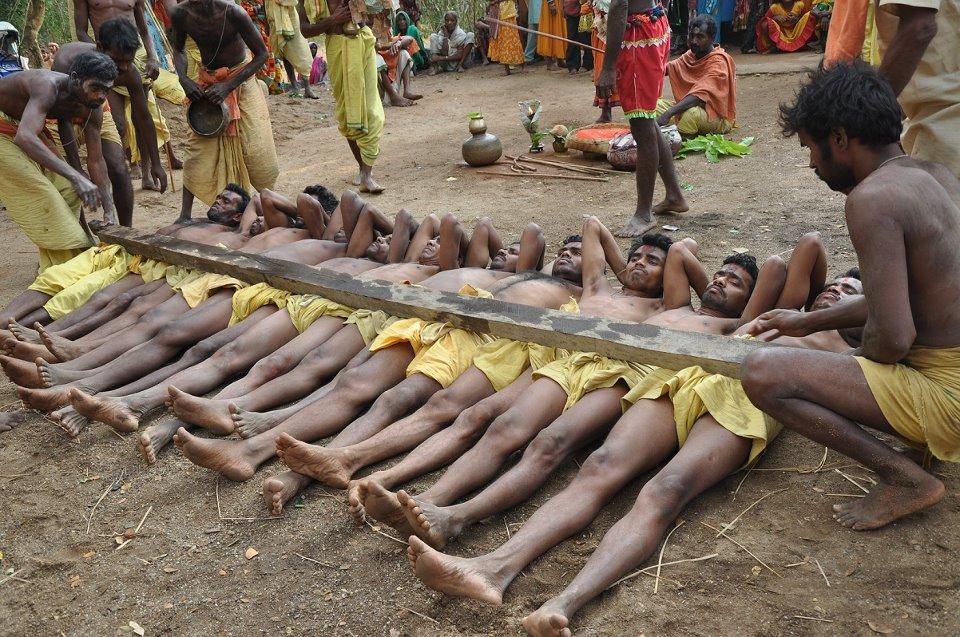
People of Kandhamal district

Census 2011 counted 7,33,110 people in 1,72,022 households in Kandhamal district. 9.9% lived in towns, and the literacy rate (age 7 and over) was 64.1%. The census recognised 4 towns in the district.

Population
7,33,110
3,59,945 male · 3,73,165 female
Households
1,72,022
about 4.3 people each
Literacy (age 7+)
64.1%
men 76.9% · women 51.9%
Females per 1,000 males
1,037
Girls per 1,000 boys (0–6)
962
People per km²
91
  • Rural6,60,831 (90.1%)
  • Urban72,279 (9.9%)
Scheduled Castes
1,15,544 (15.8%)
Scheduled Tribes
3,92,820 (53.6%)

What the 3,55,349 workers did

  • Cultivators60,098 (16.9%)
  • Agricultural labourers42,795 (12.0%)
  • Household industry4,094 (1.2%)
  • Other work60,125 (16.9%)
  • Marginal workers1,88,237 (53.0%)

Marginal workers worked less than six months of the year.

Source: Census of India 2011, Primary Census Abstract (district, sub-district and town level). Figures are from 2011, the most recent census with published district, town and village figures.

Facilities in the villages of Kandhamal

How many of the 2,417 inhabited villages of this district had each facility within the village itself, from the Census 2011 Village Directory. Together the 2,587 villages cover 4,385 km², 24% of it sown with crops and 45% forest.

Education

  • Primary school1,675 of 2,417
  • Middle school503 of 2,417
  • Secondary school152 of 2,417
  • Senior secondary school33 of 2,417
  • Degree college15 of 2,417

Health

  • Primary health centre5 of 2,417
  • Health sub-centre150 of 2,417
  • Anganwadi centre1,290 of 2,417

Water & power

  • Treated tap water0 of 2,417
  • Hand pump2,055 of 2,417
  • Electricity for homes894 of 2,417

Roads & transport

  • All-weather road1,409 of 2,417
  • Public bus165 of 2,417
  • Mobile phone coverage1,419 of 2,417

Services

  • Post office or sub post office320 of 2,417
  • Commercial bank1 of 2,417
  • Ration (PDS) shop160 of 2,417
  • Weekly haat63 of 2,417
Primary schools
1,841
Middle schools
564
Secondary schools
210
Degree colleges
15
Primary health centres
11
Health sub-centres
150

Main crops named by villages: Paddy (2,036), Turmeric (1,081), Maize (502), Ginger (229), Kandula Dal (176), Horse Gram (175), Black Gram (174), Til (143). Handicrafts: Leaf Plates (69), Hill Broom (61), Wooden Material (57), Broomstick (10), Leafe Plate (8), Bricks (1).

Source: Census of India 2011, District Census Handbook: Village and Town Directory (Odisha). The facilities were recorded for the 2011 census (reference year 2009 for most items); many places have changed since. Facilities in towns are not included.

Towns of Kandhamal

2 statutory towns (municipal corporation, municipality, notified area council or industrial township) and 2 census towns — places the census counted as urban but which are governed by gram panchayats.

TownTypePopulationLiteracyWards
PhulabaniMunicipality37,37189.0%13
BaligudaCensus town16,61184.1%–
G. UdayagiriNotified Area Council11,30287.0%13
DaringbadiCensus town6,99581.0%–

Population of the town itself; for towns with outgrowths, the town page also gives the figure including them. Ward counts are the census wards of 2011.

Census sub-districts: town and country

Sub-districtPopulationRuralUrbanLiteracy
Gochhapada35,59335,593053.0%
Phulabani41,76241,762070.1%
Phulabani Town38,7321,36137,37188.9%
Khajuripada42,56042,560072.4%
G.Udayagiri48,84637,54411,30273.4%
Tikabali48,70948,709066.4%
Chakapada22,75222,752069.5%
Sarangagarh35,33535,335069.2%
Phiringia53,57053,570063.4%
Baliguda97,08480,47316,61160.5%
Nuagaon19,36419,364064.7%
Tumudibandha28,53828,538055.6%
Belaghar19,50619,506039.6%
Kotagarh47,90047,900047.5%
Brahmanigaon36,50536,505057.3%
Daringbadi63,52456,5296,99559.8%
Raikia52,83052,830067.7%

Odisha's census sub-districts are police-station areas, not revenue tahasils.

History

According to the district administration, in the Mauryan period (3rd century BCE) this hill country was part of the unconquered Atavika (forest) lands. In later centuries the surrounding plains were held by the principalities of Boudh, Ghumusar and Khemundi, while the hill Kandhas kept a large measure of independence under their own chiefs. The district administration notes that the Bhanjas held the area until 1835 and that the British gradually brought it under control between about 1830 and 1880.

The Kandha hills of Ghumusar and Boudh drew British attention in the 1830s and 1840s. After the fall of the Ghumusar Bhanjas in 1835–1836, Kandha leaders resisted Company rule. Officers such as Samuel Charters Macpherson were then posted to the hill tracts. In November 1845 Macpherson was made the government's agent for suppressing the meriah, the human sacrifice once practised by some Kandha groups. Kandha resistance in the hills continued for some years afterwards.

According to the district administration, the Kandhamal area was part of Boudh until 1855, after which British administration separated it from Boudh. The old Phulbani district was later divided, and Kandhamal district came into being on 1 January 1994.

In 2008 the district suffered serious communal violence, in which at least 39 people were killed and thousands of homes were damaged or destroyed.

Places to visit

Daringbadi

Daringbadi, at about 915 m, is often called the "Kashmir of Odisha" for its cool winters, pine plantations and coffee gardens. Odisha Tourism lists a coffee garden about 3 km from the town, Midubanda waterfall about 40 km away and the Mandasaru valley about 35 km away. See the Daringbadi travel guide.

Belghar

Belghar is a high, forested area of the district with a nature camp, grasslands and streams. It is home to the Kutia Kandha, a Kandha group that still practises shifting cultivation. Visitors should respect village customs and seek permission before photographing people.

Phulbani and nearby waterfalls

Phulbani is a quiet hill town and a base for the Putudi, Urmagarh and Katramal waterfalls and the Pilasalunki reservoir. Putudi, about 18 km away, is the most visited of these.

Balaskumpa

The shrine of Goddess Barala Devi at Balaskumpa, near Phulbani, is one of the district's main temples. Its biggest festival is held at Dussehra.

Kotagarh Wildlife Sanctuary

Kotagarh, with Baliguda as its nearest town, is one of Odisha's less-visited sanctuaries. It is known for the four-horned antelope and for forest waterfalls such as Ludu.

How to reach

  • By air: The nearest major airport is Biju Patnaik International Airport, Bhubaneswar, about 211 km from Phulbani by road. There is also an airstrip at Gudari, about 5 km from Phulbani.
  • By rail: There is no railway in the district. The usual railheads are Brahmapur (Berhampur), about 165 km from Phulbani and roughly 120–150 km from Daringbadi depending on the route, and Rairakhol, about 100 km from Phulbani.
  • By road: Buses connect Phulbani with Bhubaneswar, Brahmapur, Cuttack and Boudh. Daringbadi is usually reached by road from Brahmapur.

For neighbouring districts, see Boudh, Ganjam, Nayagarh and Gajapati.

Temples (1)

  • Virupaksha Temple Odisha · ବିରୁପାକ୍ଷ ମନ୍ଦିର

Photos and map links in the temple directory. Today's tithi, sunrise and Rahu Kala here.

Railway stations

No railway station is mapped inside the district. Village pages list the nearest stations outside it.

Culture and festivals

The Kandha (Kondh) are the largest community in Kandhamal. Many Kandhas speak Kui, a Dravidian language; Britannica notes that Kandhas in the plains increasingly speak Odia, while Kui remains strong in the remote hills. Most Kandhas are now rice farmers. Some groups, such as the Kutia Kandha, keep their traditional shifting (swidden) cultivation. Tribal festivals mentioned in accounts of the district include Sisaa Laka, Maranga Laka, Bora Laka and Kedu Laka.

Danda Nacha, the Chaitra ritual devoted to Shiva, is performed for 13 days in parts of Kandhamal. Hindu festivals such as Dussehra, Holi, Diwali, Shivaratri, Ram Navami and Janmashtami are widely observed. The Odia spoken around Phulbani, sometimes called Phulbani Odia, borrows words from Kui and from neighbouring dialects (see Odia dialects).

According to the Ministry of MSME's district profile, local crafts include a terracotta cluster at Ganjuguda and leaf-plate making at Baliguda. The district's registered Geographical Indication is Kandhamal Haladi (see Odisha GI tags).

Food

Rice is the staple food and main crop. The district's signature ingredient is Kandhamal Haladi, a turmeric grown mainly by Kandha farmers using traditional methods without chemical fertilisers. It is used in everyday Odia cooking and is sold across India and abroad.

Geography and climate

Kandhamal lies on a broken plateau in the Eastern Ghats, with ranges, deep valleys and narrow river basins. Altitudes range from about 300 m to 1,100 m. Phulbani stands at about 485 m, and Daringbadi at about 915 m. The district borders Boudh, Nayagarh, Ganjam, Gajapati, Rayagada and Kalahandi.

Forests cover about 5,709 sq km, roughly 71% of the district. Sal is the main tree, along with species such as bija, asan and sandalwood. The forests yield bamboo, kendu leaf, tamarind, mahua flowers and sal seeds.

The Salunki and Pilasalunki rivers flow near Phulbani. The Rushikulya rises in the Rushimala hills near Daringbadi and flows south-east into Ganjam. Other streams include the Bhrutanga. Waterfalls are common: Putudi (about 18 km from Phulbani), Urmagarh (about 21 km) and Katramal (about 31 km) are among the best known.

The Kotagarh Wildlife Sanctuary (399.05 sq km, notified in 1981) protects elephants, gaur, sambar, leopards and sloth bears, and is noted for the four-horned antelope (chousingha).

FeatureDetail
Area8,021 sq km
ForestAbout 71% of land area
ElevationAbout 300–1,100 m
ClimateTropical, with hot summers and cool to cold winters
Average temperaturesAbout 40 °C in summer; winter nights can fall to about 5 °C, colder at Daringbadi
RainfallAbout 1,587 mm a year
Protected areaKotagarh Wildlife Sanctuary

Daringbadi and nearby uplands are among the coldest places in Odisha in December and January, and frost is common on winter mornings.

Economy

Agriculture and forest produce support most households. Rice is the main crop, and the uplands are used for dry crops, horticulture, sericulture and floriculture.

Turmeric is the most important cash crop. The Kandhamal Apex Spices Association for Marketing (KASAM), set up in 2000, applied for the GI tag, which was granted on 1 April 2019. It was Odisha's first turmeric GI. At that time ANI reported that turmeric was grown on about 13,000 hectares and that the district produced about 25,000 tonnes of dry turmeric a year. KASAM fixed a benchmark price for farmers to reduce dependence on middlemen.

Other activities include collection of minor forest produce, a turmeric and spices processing cluster at Phulbani, small agro-based industries and some graphite mining. The district has no railway line, which limits industrial growth.

Climate of Kandhamal

In Kandhamal district (at 20.15°N, 84.07°E), the hottest month is May (average highs of 36°C) and the coolest nights come in Jan (14°C). About 1600 mm of rain falls in a year, most of it in the monsoon; Jul is the wettest month.

JanFebMarAprMayJunJulAugSepOctNovDec
Average high (°C)252933363631282728272625
Average low (°C)141620232524232222201715
Rainfall (mm)19131928562284083892911052516
Rainy days2123517242421931

Averages for 1995–2024 at that point (671 m above sea level), from the Open-Meteo historical weather API (ERA5 reanalysis by ECMWF/Copernicus, CC BY 4.0) — modelled values on a ~25 km grid, not station readings from the India Meteorological Department. A rainy day has 2.5 mm or more.

Blocks, sub-districts, panchayats & villages

Choose a block, sub-district or town to see its details and its gram panchayats and villages. Open any village for its own page.

Counts below: Local Government Directory, December 2022 snapshot (LGD villages, which can differ from the district administration's revenue-village count).

Blocks
12
Sub-districts
17
GPs
171
LGD villages
2,599

Community development block

Baliguda

Gram panchayats
14
Villages
249
LGD block code
3422
District
Kandhamal
Open full block page

Villages (…)

All blocks in Kandhamal

BlockGPsVillagesVillage pop.LiteracyST share
Baliguda1424954,17055.0%63.1%
Chakapad1218548,46868.6%46.6%
Daringibadi252951,03,00656.6%64.7%
G.udayagiri88430,93868.4%66.0%
K.nuagan1422055,72065.9%50.3%
Khajuripada1425051,74671.6%50.1%
Kotagarh1514651,82847.7%59.3%
Phiringia2444683,01259.2%57.8%
Phulbani1122140,08869.9%56.5%
Raikia1215051,81367.4%56.6%
Tikabali1113044,75166.9%54.4%
Tumudibandh1122345,29148.7%61.1%

GPs and villages: Local Government Directory (Dec 2022). Village population, literacy and Scheduled Tribe share: sum of the block's villages in Census of India 2011, Primary Census Abstract (village level).

All census sub-districts

Towns (urban local bodies)

  • Baliguda · Notified Area Council · no matching Census 2011 town
  • G. Udayagiri · Notified Area Council
  • Phulabani · Municipality

Assembly constituencies in Kandhamal

Source: Local Government Directory (lgdirectory.gov.in), Government of India — data dump of December 2022 via github.com/planemad/india-local-government-directory. Sub-districts follow the Local Government Directory, which for Odisha uses the Census sub-districts (police-station areas) — these are not the same as revenue tahasils. Boundaries and names change over time; check the district administration for current status.

Frequently asked questions

What is the headquarters of Kandhamal district?

The headquarters is Phulbani, a hill town on the Salunki river about 211 km by road from Bhubaneswar.

Why is the district called Kandhamal?

The name comes from the Kandha (Kondh) people, who make up the largest community in the district. Scheduled Tribes formed 53.58% of the population at the 2011 Census.

When was Kandhamal district formed?

Kandhamal district was created on 1 January 1994, when the old Phulbani district was divided into Kandhamal and Boudh districts.

What is Kandhamal famous for?

Kandhamal is known for its forested hills and waterfalls, the cool hill station of Daringbadi, the Kandha people and their Kui language, and Kandhamal Haladi, an organically grown turmeric with a GI tag since 2019.

Is there a railway station in Kandhamal?

No. The district has no railway line. The nearest stations usually used are Brahmapur (Berhampur), about 165 km from Phulbani, and Rairakhol, about 100 km away.

Sources & references

  1. 1Kandhamal district — Wikipedia
  2. 2History — District Administration, Kandhamal (NIC)
  3. 3Kandhamal District: Census 2011 data — Census2011.co.in (compiled from Census of India 2011)
  4. 4Brief Industrial Profile of Kandhamal District — MSME Development Institute, Ministry of MSME, Government of India
  5. 5Odisha: Turmeric produced by tribal farmers gets GI tag as 'Kandhamal Haldi' — ANI
  6. 6Khond (people) — Encyclopaedia Britannica
  7. 7Phulbani — Wikipedia
  8. 8Kotgarh Wildlife Sanctuary — Wikipedia

Last reviewed . How we check articles

Report an error