Skip to content

Kendrapara district

କେନ୍ଦ୍ରାପଡ଼ା ଜିଲ୍ଲା

Kendrapara is a coastal delta district of Odisha, home to Bhitarkanika's mangroves and crocodiles, Gahirmatha turtle beach, the Baladevjew temple and Rasabali.

Headquarters
Kendrapara
Population (2011)
1,440,361
Area
2,644 sq km
Villages
1,571
Literacy (2011)
85.2%
Towns (2011)
2

Kendrapara (କେନ୍ଦ୍ରାପଡ଼ା) is a coastal district in the delta of the Brahmani, Baitarani and Mahanadi rivers in eastern Odisha, with the Bay of Bengal on its east. Its headquarters is the town of Kendrapara, home to the temple of Baladevjew (Balabhadra), which is why the town is also called Tulasi Kshetra. The district is best known for the mangroves and saltwater crocodiles of Bhitarkanika and for the olive ridley turtle beaches of Gahirmatha.

Kendrapara district was carved out of Cuttack district on 1 April 1993. It forms a single sub-division with nine tehsils and blocks: Aul, Derabish, Garadpur, Kendrapara, Mahakalapada, Marshaghai, Pattamundai, Rajkanika and Rajanagar.

The district covers 2,644 sq km and had 1,440,361 people at the 2011 Census. Only about 6% lived in towns, and literacy stood at 85.15%. Odia is spoken by about 91% of residents, Bengali by about 5% and Urdu by about 3%. The district's five Assembly seats all belong to the Kendrapara Lok Sabha constituency, which also includes two seats in Cuttack district.

People of Kendrapara district

Census 2011 counted 14,40,361 people in 3,21,934 households in Kendrapara district. 5.8% lived in towns, and the literacy rate (age 7 and over) was 85.2%. The census recognised 2 towns in the district.

Population
14,40,361
7,17,814 male · 7,22,547 female
Households
3,21,934
about 4.5 people each
Literacy (age 7+)
85.2%
men 91.5% · women 79.0%
Females per 1,000 males
1,007
Girls per 1,000 boys (0–6)
926
People per km²
545
  • Rural13,56,827 (94.2%)
  • Urban83,534 (5.8%)
Scheduled Castes
3,09,780 (21.5%)
Scheduled Tribes
9,484 (0.7%)

What the 4,66,890 workers did

  • Cultivators1,22,975 (26.3%)
  • Agricultural labourers70,136 (15.0%)
  • Household industry9,261 (2.0%)
  • Other work1,19,893 (25.7%)
  • Marginal workers1,44,625 (31.0%)

Marginal workers worked less than six months of the year.

Source: Census of India 2011, Primary Census Abstract (district, sub-district and town level). Figures are from 2011, the most recent census with published district, town and village figures.

Facilities in the villages of Kendrapara

How many of the 1,414 inhabited villages of this district had each facility within the village itself, from the Census 2011 Village Directory. Together the 1,546 villages cover 2,298 km², 52% of it sown with crops and 5% forest.

Education

  • Primary school1,235 of 1,414
  • Middle school744 of 1,414
  • Secondary school385 of 1,414
  • Senior secondary school61 of 1,414
  • Degree college38 of 1,414

Health

  • Primary health centre2 of 1,414
  • Health sub-centre209 of 1,414
  • Anganwadi centre1,289 of 1,414

Water & power

  • Treated tap water0 of 1,414
  • Hand pump1,380 of 1,414
  • Electricity for homes1,414 of 1,414

Roads & transport

  • All-weather road976 of 1,414
  • Public bus143 of 1,414
  • Mobile phone coverage1,414 of 1,414

Services

  • Post office or sub post office348 of 1,414
  • Commercial bank2 of 1,414
  • Ration (PDS) shop733 of 1,414
  • Weekly haat87 of 1,414
Primary schools
1,688
Middle schools
850
Secondary schools
492
Degree colleges
40
Primary health centres
8
Health sub-centres
209

Main crops named by villages: Paddy (1,009), Pulses (393), Vegetable (97), Brinjal,Potato (48), Potato (15), Jute (9), Kidney Bean (9), Vegetables (8). Handicrafts: Bamboo Products (4), Earthern Pots (3), Teracota Articles (1).

Source: Census of India 2011, District Census Handbook: Village and Town Directory (Odisha). The facilities were recorded for the 2011 census (reference year 2009 for most items); many places have changed since. Facilities in towns are not included.

Towns of Kendrapara

2 statutory towns (municipal corporation, municipality, notified area council or industrial township) and 0 census towns — places the census counted as urban but which are governed by gram panchayats.

TownTypePopulationLiteracyWards
KendraparaMunicipality47,00689.3%21
PattamundaiNotified Area Council36,52886.9%20

Population of the town itself; for towns with outgrowths, the town page also gives the figure including them. Ward counts are the census wards of 2011.

Census sub-districts: town and country

Sub-districtPopulationRuralUrbanLiteracy
Rajkanika1,40,8071,40,807086.1%
Rajnagar1,63,4501,63,450084.9%
Jamboo Marine29,49129,491074.9%
Aali1,37,8001,37,800085.5%
Pattamundai2,19,0631,82,53536,52885.2%
Kendrapara47,006047,00689.3%
Kendrapara Sadar1,58,9851,58,985086.4%
Nikirai67,94667,946085.3%
Derabish65,90965,909085.9%
Patkura1,77,3241,77,324086.2%
Marsaghai1,08,1631,08,163085.7%
Mahakalapada1,24,4171,24,417080.9%

Odisha's census sub-districts are police-station areas, not revenue tahasils.

History

According to the district administration, the name Kendrapara is linked to the legendary figure Kandarasura. The coast had a long maritime past. The administration notes that some historians identify a port of Ptolemy's time with Mayuri gaan (formerly Maipur) in the old Kanika estate. Places such as Pattamundai and Chandol appear in old records as trading centres (see Odisha's maritime history).

In the medieval and early modern periods the area was divided among local estates. The district administration names three main ones: Kujang (Sandha family), Aul (Dev family) and Kanika (Bhanja family). According to Wikipedia, the original Baladevjew temple was destroyed in 1661 by a Mughal official under Aurangzeb. The present temple was built in 1761, during Maratha rule, by the Raja of Kujang, Gopal Sandha, and the zamindar of Chhedara, Srinivas Narendra Mahapatra.

After the British conquest of Odisha in 1803, the area became part of Cuttack district. The Kendrapara municipality, established on 10 March 1869, is described by the administration as the oldest in Odisha. Schools opened from 1844, and the Frazer Girls' School followed in 1893.

In the freedom movement, local leaders such as Jadumani Mangaraj and Narayan Birabar Samanta were prominent, and the district administration records that Mahatma Gandhi made a padayatra (walking tour) through Kendrapara. After independence, Biju Patnaik represented the Kendrapara Lok Sabha seat from 1977 to 1985. Kendrapara became a separate district in 1993.

Places to visit

Baladevjew Temple

The temple of Baladevjew (Balabhadra, elder brother of Jagannath) at Ichhapur in Kendrapara town is the district's most important shrine. Balabhadra is worshipped as the main deity, with Jagannath and Subhadra beside him, and a separate shrine is dedicated to Tulasi. The temple's Ratha Yatra in the month of Ashadha (June–July) is famous for Baladevjew's large chariot, the Brahma Taladhwaja. The sweet Rasabali is one of its best-known offerings.

Bhitarkanika National Park

Bhitarkanika's tidal creeks and mangrove forests are one of India's main strongholds of the saltwater crocodile. The January 2024 census counted 1,811 crocodiles, up from 1,192 in 2000, as reported by Down To Earth. The park is also rich in birds; Wikipedia records about 320 species. Visitors explore it by boat from Khola (reached via Rajnagar) or from Chandbali in Bhadrak district. The park is closed every year from 1 May to 31 July for the breeding season. See the Bhitarkanika travel guide.

Gahirmatha

The beaches of Gahirmatha, which separate the Bhitarkanika mangroves from the sea, are one of the world's most important mass-nesting sites for olive ridley turtles. The beach is inside a protected marine sanctuary, so check with the forest department before planning a visit.

Pentha and the eroding coast

OrissaPOST reported in 2023 that Pentha beach was the second-worst eroded beach in Odisha after Satabhaya. Geosynthetic tubes have been laid there to slow the sea, and the site shows clearly how a changing shoreline affects coastal villages.

Aul

Aul was the seat of the old Aul estate. The district administration notes the Barahajew (Varaha) temple there, and the Ministry of MSME lists Aul among the district's main tourist places.

How to reach

  • By air: The nearest airport is Biju Patnaik International Airport, Bhubaneswar, about two and a half hours by road from Kendrapara. The Kendrapara district site gives about 155 km from Bhubaneswar to Bhitarkanika.
  • By rail: The usual railheads are Cuttack, about 54 km from Kendrapara town, and Bhadrak, about 55 km from Chandbali for the northern entry to Bhitarkanika.
  • By road: Kendrapara is linked to Cuttack by State Highway 9A and to NH-16 towards Bhubaneswar. Rajnagar and the Khola gate of Bhitarkanika are reached by road from Kendrapara, and Khola is about 30 km from Rajnagar.

For neighbouring districts, see Jagatsinghpur, Cuttack, Jajpur and Bhadrak.

Temples (8)

  • Baladevjew Temple · ବଳଦେବଜୀଉ ମନ୍ଦିର
  • Baladevjiu Temple
  • Chandramauli Temple
  • Dadhibamana Temple
  • Golakbihari Temple
  • Lakhmi Varaha Temple · ଲକ୍ଷ୍ମୀ ବରାହ ମନ୍ଦିର
  • Laxmivaraha Temple
  • Sakhibata · ସଖୀବଟ

Photos and map links in the temple directory. Today's tithi, sunrise and Rahu Kala here.

Railway stations

5 stations and 0 halts inside the district, as mapped on OpenStreetMap; some on new lines may not yet have regular trains.

Culture and festivals

Kendrapara's religious life centres on Baladevjew. The district celebrates the Ratha Yatra on a grand scale, and the town's identity as Tulasi Kshetra comes from the local tradition that Tulasi is Balabhadra's consort. Coastal festivals such as Boita Bandana, Raja Parba and Durga Puja are widely observed.

According to the district administration, the musician Gokul Srichandan gathered well-known musicians at Bada Kotha and promoted Odia song, and he made a recording of an Odia song in 1899. The Odia writer Binapani Mohanty, winner of the Sahitya Akademi Award, came from a family of Chandol near Kendrapara.

Local crafts listed in the Ministry of MSME's district profile include golden grass work, bamboo craft and terracotta.

Food

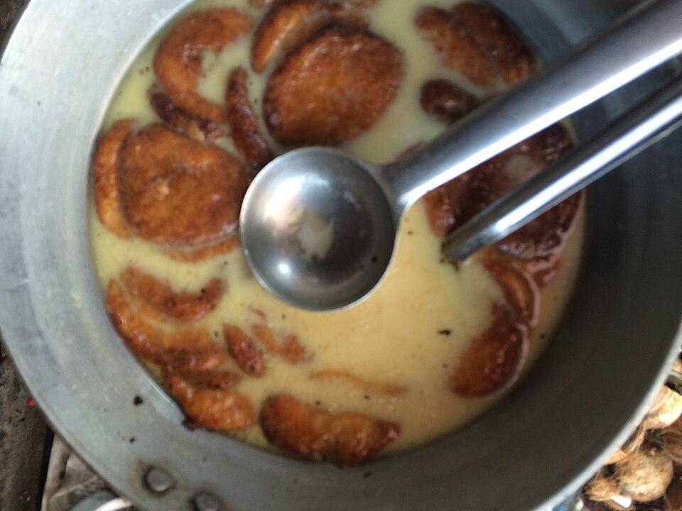
  • Rasabali: fried discs of chhena (fresh cheese) soaked in thickened, sweetened milk. It is offered as bhoga at the Baladevjew temple, and Kendrapara Rasabali received a Geographical Indication in October 2023 (see Odisha GI tags).

Geography and climate

Kendrapara is flat, fertile delta land crossed by many rivers and creeks. It borders Bhadrak to the north, Jajpur to the north-west, Cuttack to the west, Jagatsinghpur to the south and the Bay of Bengal to the east. According to Wikipedia, its coastline runs for about 48 km, from Dhamra Muhan in the north to Batighar in the south.

The Ministry of MSME's district profile lists the Birupa, Brahmani, Luna, Paika, Chitrotpala and Gobari among the district's rivers, along with many tributaries and canals. In the north-east the Brahmani and Baitarani reach the sea through a maze of tidal creeks lined with mangroves, the heart of Bhitarkanika.

Two major protected areas lie on the coast:

Protected areaKey facts
Bhitarkanika Wildlife SanctuaryDeclared 22 April 1975; about 672 sq km of mangroves and wetland
Bhitarkanika National ParkDeclared 16 September 1998; about 145 sq km, the core of the sanctuary
Bhitarkanika Mangroves (Ramsar site)Designated 19 August 2002
Gahirmatha Marine SanctuaryNotified 27 September 1997; about 1,435 sq km, mostly sea

The coast is low and exposed to cyclones and sea erosion. The super cyclone of 29 October 1999 devastated coastal Kendrapara as well as neighbouring Jagatsinghpur. Erosion has swallowed most of Satabhaya, once a group of seven villages: Down To Earth reported in 2024 that six had been lost to the sea. In 2018 the administration moved 571 families to a rehabilitation colony at Bagapatia, about 12 km inland. The climate is hot and humid, with heavy monsoon rain from June to September and mild winters.

Economy

Kendrapara's economy rests on agriculture and fishing. The Ministry of MSME's profile records no large or medium industries in the district. It counted 961 registered small units, led by food-processing businesses such as rice mills, and eight artisan clusters. Fishing and crab catching support many coastal villages.

Tourism to Bhitarkanika and the Baladevjew temple brings visitors, especially between November and February. Sea erosion and cyclones are continuing challenges for coastal livelihoods, and they have led to the relocation of whole villages.

Climate of Kendrapara

In Kendrapara district (at 20.50°N, 86.42°E), the hottest month is Apr (average highs of 36°C) and the coolest nights come in Jan (16°C). About 1600 mm of rain falls in a year, most of it in the monsoon; Aug is the wettest month.

JanFebMarAprMayJunJulAugSepOctNovDec
Average high (°C)273034363634313131302927
Average low (°C)161923262828262626242016
Rainfall (mm)15152525842303363712731624522
Rainy days11335162425221221

Averages for 1995–2024 at that point (9 m above sea level), from the Open-Meteo historical weather API (ERA5 reanalysis by ECMWF/Copernicus, CC BY 4.0) — modelled values on a ~25 km grid, not station readings from the India Meteorological Department. A rainy day has 2.5 mm or more.

Notable people

  • Biju Patnaik: former Chief Minister of Odisha, Member of Parliament for Kendrapara from 1977 to 1985.
  • Jadumani Mangaraj and Narayan Birabar Samanta: leaders of the freedom movement in Kendrapara, according to the district administration.
  • Gokul Srichandan: musician who promoted Odia song in the late 19th century, according to the district administration.
  • Binapani Mohanty (1936–2022): Odia fiction writer, Sahitya Akademi Award (1990) and Padma Shri (2020), whose family came from Chandol.

Blocks, sub-districts, panchayats & villages

Choose a block, sub-district or town to see its details and its gram panchayats and villages. Open any village for its own page.

Counts below: Local Government Directory, December 2022 snapshot (LGD villages, which can differ from the district administration's revenue-village count).

Blocks
9
Sub-districts
12
GPs
249
LGD villages
1,571

Community development block

Aul

Gram panchayats
34
Villages
134
LGD block code
3434
District
Kendrapara
Open full block page

Villages (…)

All blocks in Kendrapara

BlockGPsVillagesVillage pop.LiteracyST share
Aul341341,39,92985.5%0.3%
Derabish261811,46,90086.5%0.5%
Garadapur181391,10,67286.2%0.1%
Kendrapada271421,45,33585.0%0.5%
Mahakalapada312352,11,49981.4%1.7%
Marsaghai241111,27,86786.4%0.5%
Pattamundai311491,63,23985.0%0.2%
Rajkanika291711,38,69786.1%0.0%
Rajnagar293081,70,09184.6%1.3%

GPs and villages: Local Government Directory (Dec 2022). Village population, literacy and Scheduled Tribe share: sum of the block's villages in Census of India 2011, Primary Census Abstract (village level).

All census sub-districts

Towns (urban local bodies)

Assembly constituencies in Kendrapara

Source: Local Government Directory (lgdirectory.gov.in), Government of India — data dump of December 2022 via github.com/planemad/india-local-government-directory. Sub-districts follow the Local Government Directory, which for Odisha uses the Census sub-districts (police-station areas) — these are not the same as revenue tahasils. Boundaries and names change over time; check the district administration for current status.

Frequently asked questions

When was Kendrapara district formed?

Kendrapara district was carved out of Cuttack district on 1 April 1993.

Why is Kendrapara called Tulasi Kshetra?

According to local tradition, Tulasi was the consort of Balabhadra (Baladevjew), the presiding deity of Kendrapara, and the Baladevjew temple has its own shrine to Tulasi. The town is therefore known as Tulasi Kshetra.

What is Kendrapara famous for?

Kendrapara is known for Bhitarkanika's mangroves and saltwater crocodiles, the olive ridley turtle nesting coast of Gahirmatha, the Baladevjew temple and its Ratha Yatra, and the GI-tagged sweet Rasabali.

When is Bhitarkanika closed?

Bhitarkanika National Park is closed to tourists every year from 1 May to 31 July for the crocodile breeding season. November to February is the best time to visit.

How far is Kendrapara from Cuttack?

Kendrapara town is about 54 km by road from Cuttack railway station, via State Highway 9A.

Sources & references

  1. 1Kendrapara district — Wikipedia
  2. 2History — District Administration, Kendrapara (NIC)
  3. 3Brief Industrial Profile of Kendrapara District — MSME Development Institute, Ministry of MSME, Government of India
  4. 4Bhitarkanika National Park — Wikipedia
  5. 5Marginal increase: There are 1,811 saltwater crocodiles in Odisha's Bhitarkanika, annual census reveals — Down To Earth
  6. 6Environment in elections: Sea erosion is key election issue in Odisha's Satabhaya — Down To Earth
  7. 7Odisha: Kendrapara's sweet dish 'Rasabali' gets GI tag — ThePrint (PTI)
  8. 8Baladevjew Temple — Wikipedia

Last reviewed . How we check articles

Report an error